This is part three of the posts for this year's Condo Trip. You really should read them in order. Here's a link to take you to Part One; then click on "Newer Post" at the bottom left when you get to the end.
We took a driving tour of the top photo spots in the park that we found on the Grand Teton National Park App. Well, we didn't quite make it there for sunrise, but we were close: We stopped for coffee at a convenience store on the highway, technically after sunrise, but before the sun got above the low mountain to the east. We watched fog rising from the bogs of Flat Creek across the road, then headed up into the park.
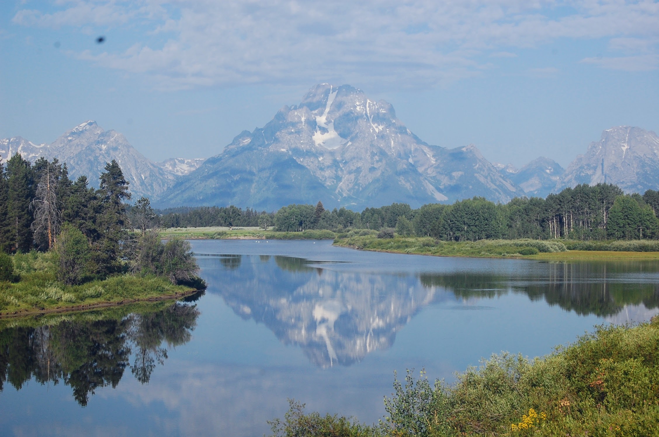
The first stop was along the Snake River, near where it passes in front of the Grand Teton (which is the name of the tallest mountain in the range, 13,770 feet high, and the prettiest). We were definitely not the first people out there this morning, but it wasn't too crowded. The small parking lot was full, and a few cars parked along the entry road. We made the easy hike out about a quarter of a mile along the riverbank -- supposedly to "a large beaver dam," but I never saw that. It was still in the high 30s; I had a windbreaker on but was wishing then that I'd also worn long sleeves
underneath. We saw a couple of sandhill cranes in the distance, too far for a decent picture (though Sherry got a recording of their calls), and other birds, and the gorgeous mountains in the near distance. We stayed there a lot longer than we needed to, just taking one picture after another.
 |
| Grand Teton & the Snake River |
It's hard to decide which picture to post here.
 |
| the Ansel Adams shot |
Next we drove up the road a ways to a place called the Snake River
Overlook. This is the spot where Ansel Adams took his most famous
picture of the park, back in 1942. I took the same picture. Mine
is probably never going to be as famous as his, but the subject matter is
as good.
 |
| Mt Moran |
Then we made the longish drive, not quite 20 miles (with a stop for breakfast at another convenience store) to the Jackson Lake overlook. This, I realized, is a place I've been twice before, once 15 years ago when we were here with Nancy & Jeff, and once on the way to Washington for another condo week. That second time I just stopped to take a picture of the fall foliage, but it still counts. It's a beautiful view (of course), but a pretty long drive, and it's right on the way to Yellowstone; so I was thinking, we should've skipped that particular stop on the Photo Trail, since we could stop there next time we passed.
 |
| Jackson Lake |
Still, it's an iconic shot, the same one I took 15 years ago. But this time the weather was better.
 |
| Jenny Lake |
The next place on our tour was Inspiration Point, which, it turns out, is on the other side of the lake. The road doesn't go there: you either hike 6 miles, or take the shuttle-boat and hike 4 miles. By this time, the Jenny Lake Visitors' Center, where the boat-dock is, was jammed with several thousand people. The parking lot was full and cars lined the road in. There were posses of children, and groups of people lined up (socially distant) for the ranger station and the park shop. We decided we would go to the Point, but not today. So I wanted to know (a) how much the boat costs, and (b) what their operating hours are. This is information you would expect to find easily, on conveniently placed signs like the ones directing you to the boat-dock. But no. It is, apparently, something of a secret.
So we hiked down to the boat dock, which is about a quarter of a mile down. When we got there, there was a long line of people blocking the way to the desk; they already had their tickets, I assume, or were waiting to buy them. I just went on down past them to a point where I couldn't get by safely; there was a bridge to the dock, divided into In and Out sides. The In side was full of people waiting; the Out side was full of people coming off an arriving boat. Once they were gone, I stood studying the layout, and finally decided that, yes, I could get to a person at the counter to ask. So I started down the Out side of the bridge. At that point, a girl who was just standing at the end of the bridge -- I'd assumed she was just waiting for someone -- asked if I had any questions she could answer (with a tone of voice like she was going to call security). Well, damn, girl, why didn't you ask me when I was standing there next to you for two minutes? Waste my time....
Anyway, so now we know how much the boat is, and that they start at 7:30 in the morning every day. So we'll be back, probably Monday or Tuesday, after the weekend crowds are gone (we hope). And at this point, we decided that we're not going to go to Yellowstone at all on this trip. We could change our minds again, but it's so far to that park that we'd have to leave at 5:30 AM just to get some early-morning pictures; and there are so many people ... and we've been there before anyway; it just doesn't seem worth going again. But, like I say, we might change our minds again. Maybe if the crowds in Grand Teton on Monday are vastly lessened, we might re-think the decision.
 |
| Chapel of the Transfiguration |
Here, once again, is a link to the picture album for this trip.
And again: if you're reading this in your email, please click on the link to the
actual blog before you delete it, so it'll register as having been seen.
My blog visitor numbers are pathetic, and you have it in your power to
do something completely altruistic that will make a certain someone happy. You
don't have to actually read it again when you visit the blog; though I think it's
always worth reading again....
No comments:
Post a Comment