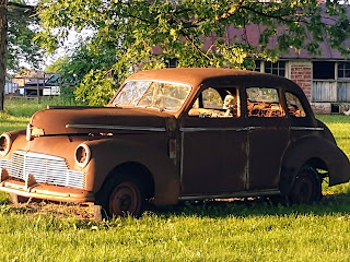
Saturday, June 20, 2020

Reading the Pandemic Wandering blog posts

One of the things about this blogger program: the posts show up in reverse chronological order. Maybe there's a way to change that, but I don't want to change it for all my posts. That would be stupid. But it would be nice if I could have a series of posts, like the ones I just made for the recent trip to Ohio, appear in reverse order, so people could easily read them in chronological order.

This is the only way I know of to do that: Click here. That will take you to the first post of the series, and then at the bottom should be a link to the next. Keep reading until you get back here.

Wednesday, June 17, 2020

Pandemic Wandering: The End, But Not The End

I woke up at 4AM in Henderson, Kentucky, feeling bright-eyed and bushy tailed so I hit the road early. There was one outlying county in Western Kentucky, right on the Mississippi River -- one of those places that has only one road going through it, a county that will require a special effort to get to -- so I knew I had to get that one this trip, no matter what. After that there were 3 counties in southern Missouri that were less vital; counties I knew I could get on the way somewhere at some point. But a quick check of Google Maps last night told me that getting them on this trip would only add 3 hours to the drive home, which would already be two days' drive, so I figured I might as well go that way.

A thing of beauty poses
at the Mississippi River
I had planned to drive back roads to the Kentucky county, but forgot to tell Google Maps that, so ended up going pretty much directly there, and probably saved an hour or more by doing that. By the time I remembered what I had planned, I was in fairly flat country, which I figured wasn't worth the added time. Likewise for the trip across Missouri, until I actually got to the 3 destination counties, which were off the main roads. The road that connects the three is an Ozark Mountains Scenic Route, so that was fairly nice. I'd give it three and a half stars for pleasure driving.

By the time I got to the second of the three -- Texas County, as it happens; county seat: Houston -- I was dying for a shady spot to take a nap in. I was falling asleep at the wheel, and in my experience, when that happens, I need like a 5-minute nap and then I'm good to go the distance. I found Emmett Kelly Park in Houston. (Emmett Kelly was famous in my parents' time; I knew the name and that he was a clown, but not like Bozo, more of a rodeo clown.) There were two shaded spots, both taken, so I ended up finding some shade at a gas station on the main highway to try to nap in. Not a success.

Decided to take the main road back to the highway, because the highway went through that last of the 3 counties. To continue on the scenic route would have taken, I figured, maybe 30 minutes longer and it just wasn't exciting enough. Turned out, though, that the main road was under construction literally the entire way back to the highway, so the scenic route probably would have been a half hour faster.

And after that, it's been freeway all the way, or highway at least; right now, I'm stopped in some town in Oklahoma on a major US highway, not a freeway, where the speed limit changes every 200 yards and there are lots of traffic signals, and at each one there's a pair of semi tractors first in line, so it's a really frustrating drive. Yet Google Maps says it's not only the fastest route, but also the only one without tolls. (Having paid all my taxes for better than 50 years, I object to having to pay again to use the highways. On the plus side, though, I discovered today that my TexasTag works in Oklahoma, too, so I don't have to stop at the cash window. It makes the whole transaction only slightly less objectionable.)

Tomorrow I will get home, and it will be boring all the way, so I won't bother writing another post but will just let this one be the wrap-up. On a theme I introduced in a previous post, my little Sacramento Jag is drawing admiration where ever I stop. A convenience store clerk came out to look at it and to talk about what a joy it must be to drive in "these hills 'round yar" but cautioned me to be careful because "these folks drive with a sense of entitlement." That was the only multisyllabic word he used in the whole conversation. A guy at the hotel last night insisted on parking his truck on one side of my car and his motorcycle on the other, because "that's a purty car and these people, they don't care, they'll ding it up" otherwise. And a lady at a gas station asked if it was OK if she took pictures of my car. I said sure, just leave a dollar under the windshield wiper.

It's an ego boost. At the same time, it reminds me that it's not me. Nobody wants my picture....

And once again, here's a link to the pictures from this trip. The only ones I took today were the one above, and a similar one, so if you've already looked at them there won't be anything new to see.

Oh, one last thing, because I told the clerk at tonight's hotel desk that this was going in my blog: the fancy electric sign out front said rates started at $39.95, but the cheapest rate she had was $50 a night. I asked her who the $39.95 rate was for, disabled veterans and first responders? She said no, "This is so embarrassing ... we lost the manual for that sign...." So until the LED bulbs burn out in 30 years, it's going to be flashing $39.95.

I suggested she get a triggerhappy sheriff's deputy with a shotgun.

Tuesday, June 16, 2020

Pandemic Wandering, Day 6

So I've been through all the counties of Ohio now; and today I went through all the counties I'd planned to get to in Indiana. The original plan is to get one more county in Kentucky, and a few in southern Missouri, before heading home. That may change: after I post this blog I'm going to get on Google Maps and decide just how badly I want those remaining counties, compared to just how badly I want to get home.

Ohio was ... well, not very exciting. Pretty enough, like England after a good ironing. Everything green, farm after farm, copses of trees surrounded by fields, a stream here, a stream there, quaint little towns each with its Marathon station and six churches. The highways run straight from one to the next, a legacy of the Northwest Ordinance of 1787 (that's the law that gave us townships, ranges and sections, and drew all those nearly-straight lines on the map). Dull, orderly, settled.

Indiana is similar, although as you get close to the Ohio River it gets a little disorderly, and that's where I was today, for the most part. I found myself driving alongside the path of the old Whitewater Canal, which depended on the contours of the land and so wasn't all that straight, and the road alongside respects the hills and streams, too, and while not nearly as much fun as driving in eastern Kentucky, in the Appalachian moun
abandoned lock on the
Miami & Erie Canal
tains, it was a lot more fun than driving from, say, Indianapolis to Springfield.

When I was a schoolboy I was taught that the State of New York dug the Erie Canal and commerce was magically transformed. I never knew, though, that there were other canals in the US. A lot of them. The success -- the immediate success of the Erie spurred the construction of canals all across the settled parts of the country, which meant Ohio and Indiana and Illinois. So today I saw remains of two of those: the Miami and Erie Canal, in Ohio, and the Whitewater, in Indiana.

Headquarters of the Whitewater
Canal Company (1842)


Of course, the coming of the railroad doomed canal operations to the dustiest pages of history, but for a while there, maybe 30 years, they were the Wave of the Future, and huge amounts of money were invested in their construction and maintenance. It's too bad they didn't survive long enough to become tourist attractions, like canals in Europe.

I saw some graphs on TV this evening that make me want to get home. It was a series of four graphs, representing the corona virus pandemic in four industrialised nations: Italy, Spain, France, and the US. In each of the European countries, the infection rates shot up early, then went steadily down, back almost to zero. But in the US, it shot up to a peak, dipped slightly, and has continued at the rate of roughly 20,000 new infections a day ever since. We are making no headway in countering this disease in this country. Of course, most of the infections are coming from places where people are packed closely together: nursing homes, prisons, meat plants and other labor-intensive industrial operations (and soon, Trump rallies); but people who work at those places go home and spread the infection to their families, and they go to church on Sunday and spread the infection to their coreligionists, and they go to the takeout counter at the local restaurant and spread the infection to the workers there, who then go home and spread it to their families, their coreligionists, their friends ... more slowly, perhaps, but as relentlessly. And since, from what I've seen on this trip, very few people are taking the whole thing seriously, I am not as willing to be out among these people as I was when I thought San Antonio's response to the problem was normal, i.e., everybody in a mask, everybody keeping distance.

I guess our best hope for the future is that all the people who go to the Trump rallies next week in Tulsa and Mobile, and where ever else he's going to be, infect each other and die before the November election. That way we'll have a better chance of getting a competent government in place come January, and then things can start to improve. An awful thing to wish for, and I don't honestly wish for it. But there would be a certain poetic justice, a cosmic irony if you will, if it happened that way.

Oh, and once again, here's a link to all the pictures from this trip.

Monday, June 15, 2020

Pandemic Wandering, Day 5

So this day was fairly clearly bifurcated. In the morning, I drove through Jaguar Heaven: narrow winding mountain roads in good condition with little traffic and gorgeous weather: dramatic patches of fog in the hollers, puffy white clouds higher up. The scenery was consistently pretty all morning, with forest and streams and occasional small towns. I got all the counties of Kentucky that I'd intended to pass through, and got to the Ohio River around two o'clock in the afternoon.

Within ten minutes everything had changed. As soon as the big river is out of sight in the rearview mirror, Ohio flattens out and becomes dull. Traffic appears out of nowhere to clog the straight, monotonous highways, bunching at the many traffic signals (There is, I think, only one in all of Kentucky east of Lexington. But every cross street in Ohio seems to warrant one, and they are always red for cars on the main road.) The blessing is that Ohio is a pretty small state, and I'm speaking as both a Westerner and a snob.

One thing in Ohio's favour: they seem to take the corona virus a little more seriously here. Most people wear masks. Businesses, while open, have done sensible things like reorganised traffic patters in the shops and restaurants with one-way aisles; disposable menus and utensils are the rule here. And everybody keeps their distance from everyone else.

I took only one photograph today, so I might as well put it here. Look closely.

Traffic jam legacy

So: I've reached the farthest point I planned to go to on this trip. That means that, technically, I started for home when I turned left on US 20 this evening. I figure it'll take me at least 3 more days to get home, probably 4; the plan is to drift back down to the Ohio River in Indiana, then clip the corner of Kentucky, mosey across southern Missouri, and then pick up a freeway in Kansas and head home. But if my previous experience with Indiana is anything to go by, I may not wait until Kansas. We'll see.

Oh, and I just remembered one other nice thing that happened today. I was stuck in traffic north of Columbus when the car next to me honked and the driver signalled that he wanted to tell me something. A brake light out? A low tire? Some piece of clothing hanging out of my trunk? I turned down the radio and dropped my window and he shouted out that I was driving his dream car.

It's not the first compliment this little grey Jag has prompted, nor even already the last, but it was the nicest and most surprising. Made me feel good, until the next closed-for-construction road I encountered. Google Maps got a workout this afternoon.

Sunday, June 14, 2020

Pandemic Wandering, Day 4

Okay! So. Off to wander. My first stop, after breakfast, was at Cummins Falls State Park, about an hour and a half out of Nashville. In order to get to the Falls themselves, and the swimmin' hole, you have to hike through The Gorge. And for that, you need a permit, $6.57. And there are a limited number of such permits given out each day. And today's permits were already sold out.

Well, that's okay, I guess; I didn't so much want to go swimming as to just see the falls. They are reportedly among the prettiest falls in the state. So there's an overlook that you can hike to without a permit, so I did that.

It's about a half mile on a mostly easy trail; a few steep spots but not bad. Very few people along the way. When I got to the overlook, there was a man and his grandson (or granddaughter; it was kind of hard to tell) in the little wedge-shaped area from which you can actually see the falls. The kid was crying because (s)he wanted to go down to the falls. You know that particularly irksome whiney cry that kids have when they're not really crying but just trying to make you think they're crying? First bad thing of the day, since I don't count not being able to get a permit. I really felt sorry for the grandfather, because you know that if he'd known to get a permit on line, he would have, and now he was defeated and diminished as a grandfather for his lack of tech savvy. I often feel defeated like that myself, though seldom diminished, and certainly never as a grandfather.

So they finally leave and I get into the wedge and drag out my big ol' digital SLR camera, the one that I spent all day yesterday taking pictures of cars with. Add a neutral-density filter to the front of the lens and aim for the falls. Nothing happens. Fuss with various settings, still nothing. Finally notice that the low battery warning is flashing. Should still have had enough juice for pictures without flash, but I drag out the other battery and change it. By now I am surrounded by a small crowd of people who have never heard of Social Distancing, and once again I am the only person with a mask. I came this close to pulling my mask down and faking a coughing fit in their direction, just to make a point.

Anyway, I got my picture.

After hiking back to the car, I started off for the New Counties, and finally got to some wonderfully challenging back roads. Twenty-mile-per-hour curves (feel those G's!), up one side of a ridge and down the other, then immediately onto another ridge. It was great. Hit a little rain that lasted about an hour, but still a nice drive. Got into Kentucky. Wasted about an hour trying to locate something called the Creelsboro Arch, also known locally as the Rock House. Found Creelsboro with no trouble, right where it was supposed to be. Followed the directions I had: one mile down this road, two miles down that road, then 6 miles down the other road. No arch. No one around to ask. Consulted a different web site, which put the arch about 4 miles further down the last road, so went there. Still no arch. Consulted another web site, which gave me the GPS co-ordinates for the arch. Plugged that in, and it put the arch about 12 miles in the opposite direction as the crow flies ... on the other side of a miles-long lake. Okay, gave up on finding the Creelsboro Arch, which wasn't all that tempting a formation anyway, it was just something to see that was supposedly along the way. So instead I continued on to my next planned stop, the West Pinnacle of Berea.

Berea College, in Berea, Kentucky, has a Forestry School that owns a forest a few miles east of the town. The forest includes half a dozen mountains and is open to the public for hiking from dawn to dusk, almost every day. I got to the huge parking area around 4pm and started up the trail. It was an easy half-mile walk to a point where there's a map of the trails and some information about the forest, including the sign that a solo hiker like me most likes to see:
Hikers Welcome

I decided to risk it. I was actually pretty comfortable about it, because there were lots and lots of people on the trail, going in both directions. (And again, only one wearing a mask: me.) After about three quarters of a mile of fairly steeply rising trail, I came to another junction. One trail went to the right, one went straight ahead, and the West Pinnacle trail went off to the left.

It started off as three-quarters of a mile of perfectly level track, absolutely deserted. I saw not a single person on the West Pinnacle trail, and except for the bear issue, I didn't mind that at all. I could stop to listen to the sounds of the forest: a woodpecker somewhere down the hill; an owl hooting not too far up the hill. Birds chirping all over, no wind to disturb the trees and mask their sound. Then the trail switched to a quarter-mile of nearly vertical track, and at one point I think I missed the trail, but found it again a little farther along. (Maybe I had chosen a path that used to be the trail?) I arrived pretty exhausted at the end, which has a pile of limestone that I couldn't find a way to climb, but circumnavigated twice. Took some pictures and started back, losing the trail again, then finding it again. There are several places where there seem to be several routes, and for all I know they all go to the same places, but it was disconcerting to think I might be sort of lost.

By the time I got back to the car it was getting on towards evening. I checked on line to see if I could locate lodging in any of the upcoming towns I was heading toward, but it seems the largest town I could expect to see in the next couple of hours was Beattyville, population 1206 and no motel. So I decided to stay in Berea. And so I didn't make it as far as Ohio today, as I'd thought I might. Gosh darn it.

(On the bright side, my room tonight is only costing me $43, including tax, and it's definitely good enough.)

And, once again, here's another link to the pictures from this trip.

Saturday, June 13, 2020

Pandemic Wandering, Day 3

Saturday, in Nashville

The real reason I made this trip was to go to Lane's Motor Museum. I won't rehash the saga of my last trip to Nashville to see it; anyone who knows me has already heard it twice, even if they don't remember it. Today, though, I got there.

I also got to the Parthenon, the only other Major Sight Worth Seeing in Nashville (in my estimation). It did not disappoint.

pardon their landscaping dust
In 1896, Tennessee had its centennial as a state. A year later (money being scarce, it took a while to get enough together) they put on a celebration, a sort of World's Fair, and as part of that, they built a replica of the Parthenon as it would have looked before the ravages of war and time had their effect. It was meant to be temporary, and was built out of cardboard and glue. When the time came to tear it down (as they did with all the other buildings of the Centennial Celebration), the city of Nashville refused to let that happen. The building had wormed its way into the civic heart. So instead of tearing it down, they rebuilt it, this time out of concrete cleverly formulated to mimic the golden colour of the original. It's used as an art museum.

As a building, it's a glory. It doesn't have the dramatic setting of the original, up on its hill, but it has all the majesty. It is an excellent demonstration of what was so great about ancient Greek architecture. As an art museum, it's less impressive. There's a modest collection, mostly of landscapes donated by some rich guy a century ago, and it hosts other small travelling exhibits; small, because there's only one room on the one floor to exhibit in. The exhibition on show today was a particularly good example of how horribly bad modern art can be when an art-school graduate gets a bit of a name in toney art circles.

There is, though, a second floor, and when you ascend the stairs to it, you are astounded. It's a single large high-ceilinged room, a re-creation of the Temple of Athena as it would have been 2500 years ago in Athens, right down to the gaudy gigantic gilded statue of Athena. It is magnificent.

The statue of Nike in Athena's hand is 6'4" tall

That took up a much bigger chunk of my morning than I had anticipated.

Then came the Lane Motor Museum, the thing that drew me back to Nashville in the first place. I go to a lot of car museums. I love looking at the stylings of cars and how they've changed over the decades. The earliest cars were unadorned machines, but it didn't take long for appearances to become important in selling those machines, and by 1920, automotive design had developed into a Thing. Back then, many cars were sold as chassis and motor, and the purchaser hired a coachwork company to put a body on it. Manufacturers noticed, and soon they were offering bodies that, they hoped, would attract buyers to their cars. By the end of the Great Depression and the start of World War II, coachbuilders were either out of business or subsumed into manufacturing companies. (Think "Body by Fisher.") Very few have survived independently to the current era.

No, not a Thunderbird;
an Audi
And styling tastes vary greatly from company to company, and from country to country. That's why this particular museum was such a draw for me: it specialises in exhibiting European cars. (Others I've seen like that are the Tampa Automobile Museum and the Mullin Automotive Museum in Oxnard, California.) Besides getting to see the different paths that foreign designers took, I also enjoy seeing the convergences between their tastes and American stylists' tastes. Right now, for example, you can look at any new car lot and see how American automotive designs have taken cues from designers in Germany and Japan, Italy and England; before, designers in those places took cues from Detroit.

And, of course, some of those foreign designs look just a little wacky to me.
1951 Hoffman (Germany)

1958 Tatra (Czechoslovakia)

1950 Lloyd (Germany)
vinyl skin over plywood

1991 Nissan (Japan)


As do some of the American designs I've seen.
1950 Martin Stationette (USA)
Those are fun to look at, but it's really for the exemplars of beauty that I go to car museums, the marriage of elegance and technological innovation. Foreign car stylists solve those marital problems in different ways from their American counterparts, and I like seeing how they do it.

And here, once again, is a link to the photo album for this trip. I apologise for the quality of the 150 or so car pictures I took today, but the building housing the collection has lots of windows and so lots of glare. You can take some comfort in knowing that I've deleted the worst of them.

Tomorrow, I head off to start counting counties, in eastern Tennessee and Kentucky; and I may even get to Ohio, but I doubt it.

2020 Pandemic Wandering, Day 2

Friday, June 12, Natchez, Mississippi to Nashville, Tennessee

The actual trace, in 2008
So I drove the entire length of the Natchez Trace Parkway. You may not know this -- I only figured it out the first time I was on the Parkway -- but the Natchez Trace Parkway and the Natchez Trace are two very different things. The Natchez Trace is the web of buffalo migratory paths and the footpaths Native Americans developed, first to follow the buffalo, and then in their trading with other tribes through what is now Mississippi; it was later improved as a Post Road in the early 19th Century, but the development of the steam-powered river boat put an end to that use.

The Parkway is just a well-maintained country road that roughly parallels the Trace, built originally as a back-to-work project of the Civilian Conservation Corps in the 1930s. There are few major towns along it -- only Jackson and Tupelo, Mississippi and Florence, Alabama -- and commercial traffic is prohibited. In the first 100 miles I drove out of Natchez, I saw another car about every nine miles. Things picked up after that, as I approached Jackson. The road is two lanes the entire length of 444 miles, and the speed limit is 50 almost the whole way. (In places it drops to 40.) It's a pleasant drive, with almost no challenge to it, and very little drama.


Putting two and two together, when planning the drive I figured nine hours, plus stops. Google Maps confirmed that estimate, giving me a time of eight and a half hours. I must've made a lot more stops than I thought, as it took me from 7:30 in the morning until 7:30 at night to make the drive. At the outset, I did make a number of stops: there are a lot of signs along the route that say things like "Historical Site, 1/2 mile," but I quickly realized they were all of the "Something used to be here" variety, so I bypassed them when I figured that out. (There are also a lot of places where you can hike portions of the actual Trace; those are of the "Come
Come Experience Misery
Experience Pre-Industrial Misery" sort, and I chose to pass on the offer.) I made a stop for a meagre lunch at Kosciusko, Mississippi (a lousy convenience-store fish sandwich) where I met another couple from San Antonio (but they live waaaay out in Ultra-Loopland, so it's not like we would ever get together). They were cruising the Parkway on a tricycle, so we had that to talk about, plus the wife is from France, so there was that.

Jackson Falls
I may have been able to make the drive on a single tank of gas, but decided that it would be cutting it uncomfortably close, so I did get off and drive 3 miles down another highway (and back) for gas in Alabama. And once I got to Tennessee there were a couple of waterfalls to check out: the first was a short walk for not much to see; the second, Jackson Falls, was a pretty steep climb down and an equally steep climb back up, but at least the falls were worth the effort. Plus I met a transplanted New Orleanian, a nice guy who invited me to join him and another Orleanian living in Nashville for dinner Saturday night. (I didn't go. I'm writing this blog instead.)

Meanwhile, I've learned two new things. Well, okay, one new thing, plus I've had one thing I already knew confirmed.

The new thing is that the hair on the top of my head has thinned to the point where I now get sunburned driving with the top down. I wear a visor (and lots of suntan lotion) when I travel, and it's never been a problem before. Now, it is, so I will have to start a search for a hat or cap that doesn't get sucked off when the car is in motion. That could be a problem, with the shape of my head. (Maybe I could get a bill cap and cut out the back part of the crown...?)

The thing I've had confirmed is that I prefer being cheap. The hotels I chose in Natchez and Nashville are the type that certain friends who've travelled with me in the past would have preferred. Not the Four Seasons by any stretch, but nicer than I usually go for; 3-star places. Since rates are low just now, what with the corona virus keeping people home, I decided to go with things my friends would prefer. It ain't me, though. I paid $87 plus tax for a room in Natchez; I could have gotten one that would have been good enough for me for less than $60. I miss the thirty bucks. This room in Nashville is about the same cost, but on top of that, there's a parking charge of $20/night that really gripes my ass. (I thought I specified "free parking" when I searched for the room on Expedia or whatever site I booked through. I may be wrong. In any case, I won't make that mistake again.) I could have gotten a perfectly decent room with free parking at a La Quinta -- several in town -- and saved more than $80.

So from now on, two stars is enough for me when I'm travelling alone. Hell, one is sufficient in most places, but I find those often aren't much cheaper than 2-star motels. (Of course, I end up in a lot of 1-star or no-star motels, because that's all a lot of small towns offer.) All I want is a conveniently-located clean room with free parking and internet (another tick mark against the place in Natchez).

And, again, here's a link to the picture album for this trip.

2020 Pandemic Wandering, Day One

I wrote this Thursday night, but couldn't publish it then because the Internet at the fancy-schmancy hotel I used was not acceptably secure. Sorry for the delay.
 
First, a rant:

We are in the middle of a serious pandemic, which surely everyone in the country knows. Unfortunately, people seem to not understand the most basic fact about this pandemic disease, which is that is spreads from one person to another through the air we breathe.

Travelling alone in a car, I feel pretty safe from infection. Stopping at a gas station seems safe enough, as I can generally do my business there entirely away from other people. Even when I go into a convenience store (because of course the card reader at the pump wasn’t working) the clerk is behind a plexiglas shield. OK, safe enough there. But when I went to a Subway shop for lunch, I saw 8 people in line, none of them wearing a mask. Even worse, the three “sandwich artists” behind the counter weren’t wearing masks. 

Those are the people who, more than anyone else, should wear masks. The are the primary vectors for the disease. They are potentially exposed to the virus by every single person who steps up to place an order, and they will pass that exposure along to every subsequent person they talk to. 

I went somewhere else for lunch. Subway sandwiches are pretty good, and I like knowing what I’m getting, nutritionally speaking, but they are not literally to die for.

OK, so that’s off my chest now.

DAY 1: Thursday, June 11, San Antonio to Natchez

The drive over was uneventful. Top down all the way, and for those who are homebound in this health emergency, I can report that intercity traffic along I-10 is only slightly less than in normal times. Certainly every over-the-road truck is out there, and traffic between Katy and Houston was heavy enough that I opted to take the Katy Tollway, where mine was one of three cars I saw using it before the tollway ended at Loop 610. And for those who know me, the fact that I was willing to pay the extra dollar to use the tollway along there should be proof enough that traffic in the mainlanes was heavy.

I got to my hotel in Natchez about 6pm. There was no one at the desk, so while I waited for the clerk to return I made some calculations and decided that I could grab a quick dinner and get to Windsor Ruins in time to take some sunset pictures there. I had planned to stop there in the morning — it’s just a few miles off the Natchez Trace Parkway, and about 40 miles from my hotel. 

So I drove up there. A nice drive: once I passed the city’s airport, there was almost no traffic at all and the sun was low enough in the sky to the west that it produced no glare and little heat. I got to the ruins, down a pleasant country lane, and was the only person there.

Windsor Ruins
Windsor Ruins are the remains of a huge plantation mansion built just before the Civil War. It survived that cataslysm largely unscathed, only to burn down in a fire 25 years later. All that remains is the Corinthian collonade that surrounded the house. I was expecting it to be as mystically eerie as the reconstructed collonade from the US Capitol’s porch that stands in the National Arboretum in Wasshington DC (see below), but because these ruins are somewhat unstable, they are surrounded by a six-foot-high chain-link fence, so you cannot walk among the columns; and the fence is high enough that, for most of its circumference, it’s very hard for even a tall person to get a good picture. I could just get my lens over the top rail if I stood on tiptoe, and not always then. (There’s also a place in back where some frustrated tourist or uncaring teenager has cut the fence open.) Still, I think I got some decent pictures (including, I hope, a couple of nice shots with the car in them. Sadly, I won’t know until tomorrow, because this fancy hotel I chose to stay in (because rates are cheap right now, what with the pandemic) has an unsecured wireless internet with an unrecognised certificate, and so Firefox, my browser of choice, will not allow me to connect to it. So I will have to wait until tomorrow to upload my pictures and have a look at them, at which time I will cut and paste this narrative from my notepad to my blog.
The collonade at the Nat'l Arboretum, in DC


And here's a link to the pictures from this trip.

Wednesday, June 10, 2020

The Adventure Resumes

Oh, this "lockdown" has been tedious. Not so much for me: my normal life before coronavirus wasn't so very different from life in lockdown. Still, plans were upset.

Several years ago I acknowledged that I had driven my little convertible into the ground, as expected, and I got rid of it with the expectation that I would find something else to replace it with; another convertible, newer and possessed of a longer
The Old One
lifespan than a 13-year-old car with close to 200,000 miles on it, but one with the legroom and trunkroom that I absolutely require for the kind of travelling I like to do; and one with something like the sexy flowing lines of the old convertible.

Well, surprise, surprise: after a search of 4 or 5 years, I accepted the fact that there simply are no newer convertibles that  have the particular combination of attributes I wanted. There are beautiful cars out there, to be sure; I'm particularly attracted to the large Mercedes convertible. But none of those pretty cars, including especially the large Mercedes, have sufficient trunk room. Once you put the top down, an adequate stowage compartment becomes a slot for a briefcase. And other pretty convertibles start out with a too-small trunk.And others have cockpits so restrictive that I can barely slide under the steering wheel.

So last year I did some reflecting, and decided that, given the limited time I have left to do the kind of travelling I want (even though I'm still only 49 again), and the limited demands I make on my road car -- averaging 40 mph on back roads, even for days at a stretch, just isn't the sort of challenge a decent vehicle, even an old one, will succumb to -- I decided that what I need is another old sexy Jag. So I bought one, in January, in California. Drove it home just in time to beat the virus to South Texas. (Possibly worse.) And so it's been pretty much sitting in my driveway, laughing at me, as I cancel one planned trip after another, waiting for some place to go.


The New One

Enough. I can "social distance" as well in a car by myself as I can in my own neighbourhood. While in past travels I have occasionally met new people, and even developed a handful of good long-distance friendships with people from across the country, and renewed some old relationships, there's I see no reason why I should feel more at risk talking briefly to a masked hotel desk clerk or a waitress in a cafe in some remote hillside community in Kentucky than I already am when fondling groceries at the local supermarket, or having coffee and chilaquiles in the local taquería. So, why sit home?

And so, my county count will resume. Come Thursday, I'm heading out. First I plan to drive the entire length of Natchez Trace Parkway (I've already driven most of it: 40 mph on a nice country road uninterrupted by cross-traffic for 8 hours), then I'm off for a wander through the backroads of Tennessee and Kentucky, visiting counties I've never been to before. (There are plenty in Kentucky, and I won't get to all of them; there are fewer in Tennessee, but I'll only get to about half of what's left.) Then, up into Ohio, where there are six counties I've never seen, all in the northwest part of that state, so I will get to all of them, and that will make Ohio the 32nd state that I finish with. I'll get to some counties in Indiana and Missouri on the way home, but again, won't finish with those. (I could, easily, if I was willing to take the time, but the Merseyside Derby is set to take place on Father's Day, and I want to be home in time to watch it with my wife. It matters, especially this year. Certainly more than a few additional counties in the midwest.)

In past years, I would post prolix accounts of my trips as I went along. (As here, for example.) That got inconvenient when I travelled with friends, as there was usually something more interesting to do than type all evening. So I just started posting links to the pictures I took that day. Then that got inconvenient, as technology issues often got in the way. So I switched to just posting links to the photo albums when I got home. Well, this time I'll be travelling alone again, so I figure to have not much else to do of an evening than post travelogues every evening, or at least most evenings, wifi permitting. That plan was threatened by the fact that both of my computers were out of action, one dead, one dying. But today my little Macbook Air was saved from the rubbish heap by the timely intercession of a not-too-inconveniently-located repair shop (and two hundred dollars), no thanks to Apple and its poorly designed website.* So I will have my little computer along, and my camera batteries are charging as I type, and maybe there will be something of interest to take a picture of, once I get to Natchez.

Stay tuned.
The County-Count Status Map (not totally up-to-date)

* for example: I forgot my Apple ID, so I clicked on the "forget?" link ... and the first thing it tells you to do is enter your Apple ID. Duh.