Wednesday, June 17, 2020

Pandemic Wandering: The End, But Not The End

I woke up at 4AM in Henderson, Kentucky, feeling bright-eyed and bushy tailed so I hit the road early. There was one outlying county in Western Kentucky, right on the Mississippi River -- one of those places that has only one road going through it, a county that will require a special effort to get to -- so I knew I had to get that one this trip, no matter what. After that there were 3 counties in southern Missouri that were less vital; counties I knew I could get on the way somewhere at some point. But a quick check of Google Maps last night told me that getting them on this trip would only add 3 hours to the drive home, which would already be two days' drive, so I figured I might as well go that way.

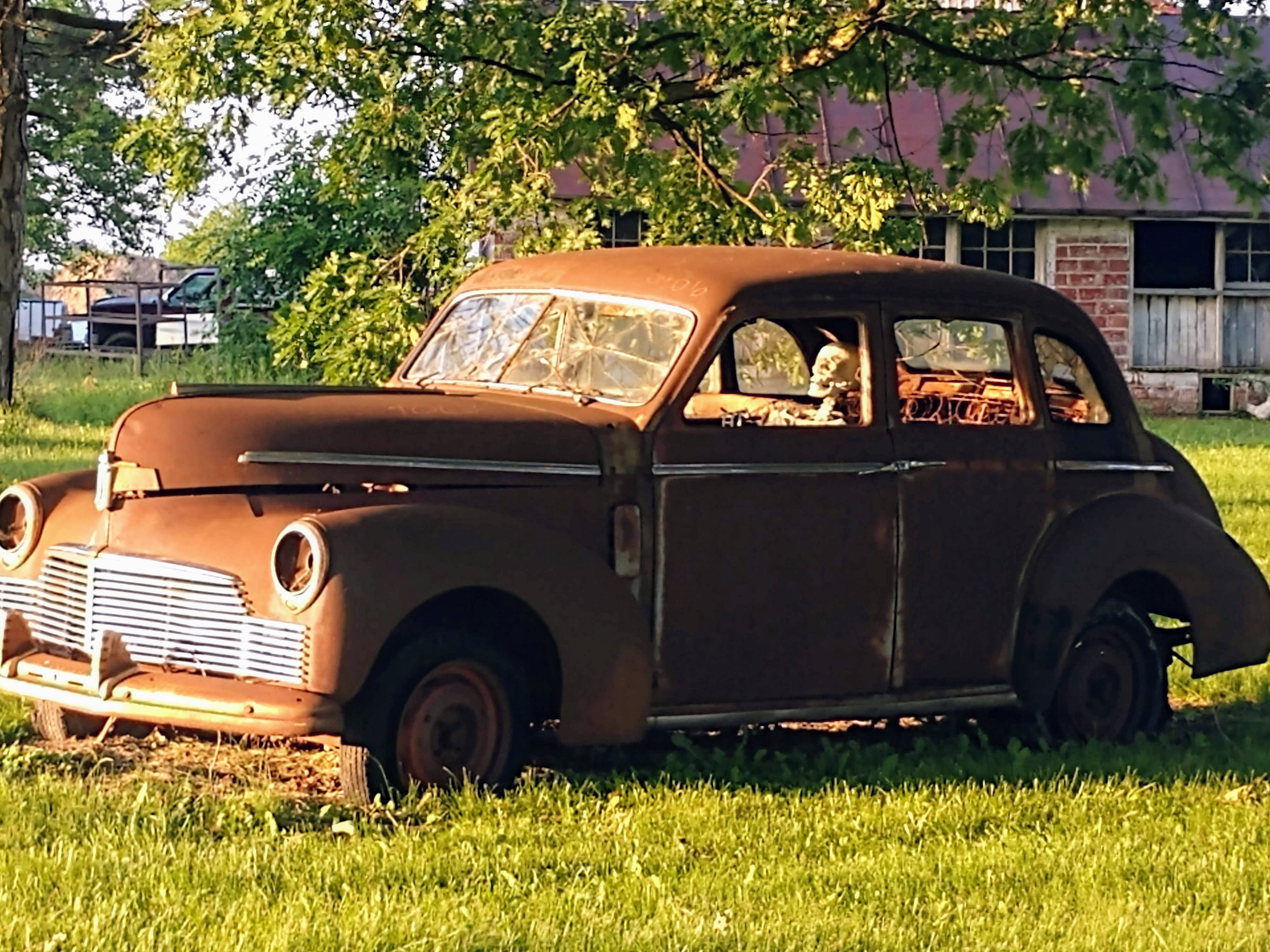
A thing of beauty poses
at the Mississippi River
I had planned to drive back roads to the Kentucky county, but forgot to tell Google Maps that, so ended up going pretty much directly there, and probably saved an hour or more by doing that. By the time I remembered what I had planned, I was in fairly flat country, which I figured wasn't worth the added time. Likewise for the trip across Missouri, until I actually got to the 3 destination counties, which were off the main roads. The road that connects the three is an Ozark Mountains Scenic Route, so that was fairly nice. I'd give it three and a half stars for pleasure driving.

By the time I got to the second of the three -- Texas County, as it happens; county seat: Houston -- I was dying for a shady spot to take a nap in. I was falling asleep at the wheel, and in my experience, when that happens, I need like a 5-minute nap and then I'm good to go the distance. I found Emmett Kelly Park in Houston. (Emmett Kelly was famous in my parents' time; I knew the name and that he was a clown, but not like Bozo, more of a rodeo clown.) There were two shaded spots, both taken, so I ended up finding some shade at a gas station on the main highway to try to nap in. Not a success.

Decided to take the main road back to the highway, because the highway went through that last of the 3 counties. To continue on the scenic route would have taken, I figured, maybe 30 minutes longer and it just wasn't exciting enough. Turned out, though, that the main road was under construction literally the entire way back to the highway, so the scenic route probably would have been a half hour faster.

And after that, it's been freeway all the way, or highway at least; right now, I'm stopped in some town in Oklahoma on a major US highway, not a freeway, where the speed limit changes every 200 yards and there are lots of traffic signals, and at each one there's a pair of semi tractors first in line, so it's a really frustrating drive. Yet Google Maps says it's not only the fastest route, but also the only one without tolls. (Having paid all my taxes for better than 50 years, I object to having to pay again to use the highways. On the plus side, though, I discovered today that my TexasTag works in Oklahoma, too, so I don't have to stop at the cash window. It makes the whole transaction only slightly less objectionable.)

Tomorrow I will get home, and it will be boring all the way, so I won't bother writing another post but will just let this one be the wrap-up. On a theme I introduced in a previous post, my little Sacramento Jag is drawing admiration where ever I stop. A convenience store clerk came out to look at it and to talk about what a joy it must be to drive in "these hills 'round yar" but cautioned me to be careful because "these folks drive with a sense of entitlement." That was the only multisyllabic word he used in the whole conversation. A guy at the hotel last night insisted on parking his truck on one side of my car and his motorcycle on the other, because "that's a purty car and these people, they don't care, they'll ding it up" otherwise. And a lady at a gas station asked if it was OK if she took pictures of my car. I said sure, just leave a dollar under the windshield wiper.

It's an ego boost. At the same time, it reminds me that it's not me. Nobody wants my picture....

And once again, here's a link to the pictures from this trip. The only ones I took today were the one above, and a similar one, so if you've already looked at them there won't be anything new to see.

Oh, one last thing, because I told the clerk at tonight's hotel desk that this was going in my blog: the fancy electric sign out front said rates started at $39.95, but the cheapest rate she had was $50 a night. I asked her who the $39.95 rate was for, disabled veterans and first responders? She said no, "This is so embarrassing ... we lost the manual for that sign...." So until the LED bulbs burn out in 30 years, it's going to be flashing $39.95.

I suggested she get a triggerhappy sheriff's deputy with a shotgun.

Tuesday, June 16, 2020

Pandemic Wandering, Day 6

So I've been through all the counties of Ohio now; and today I went through all the counties I'd planned to get to in Indiana. The original plan is to get one more county in Kentucky, and a few in southern Missouri, before heading home. That may change: after I post this blog I'm going to get on Google Maps and decide just how badly I want those remaining counties, compared to just how badly I want to get home.

Ohio was ... well, not very exciting. Pretty enough, like England after a good ironing. Everything green, farm after farm, copses of trees surrounded by fields, a stream here, a stream there, quaint little towns each with its Marathon station and six churches. The highways run straight from one to the next, a legacy of the Northwest Ordinance of 1787 (that's the law that gave us townships, ranges and sections, and drew all those nearly-straight lines on the map). Dull, orderly, settled.

Indiana is similar, although as you get close to the Ohio River it gets a little disorderly, and that's where I was today, for the most part. I found myself driving alongside the path of the old Whitewater Canal, which depended on the contours of the land and so wasn't all that straight, and the road alongside respects the hills and streams, too, and while not nearly as much fun as driving in eastern Kentucky, in the Appalachian moun
abandoned lock on the
Miami & Erie Canal
tains, it was a lot more fun than driving from, say, Indianapolis to Springfield.

When I was a schoolboy I was taught that the State of New York dug the Erie Canal and commerce was magically transformed. I never knew, though, that there were other canals in the US. A lot of them. The success -- the immediate success of the Erie spurred the construction of canals all across the settled parts of the country, which meant Ohio and Indiana and Illinois. So today I saw remains of two of those: the Miami and Erie Canal, in Ohio, and the Whitewater, in Indiana.

Headquarters of the Whitewater
Canal Company (1842)


Of course, the coming of the railroad doomed canal operations to the dustiest pages of history, but for a while there, maybe 30 years, they were the Wave of the Future, and huge amounts of money were invested in their construction and maintenance. It's too bad they didn't survive long enough to become tourist attractions, like canals in Europe.

I saw some graphs on TV this evening that make me want to get home. It was a series of four graphs, representing the corona virus pandemic in four industrialised nations: Italy, Spain, France, and the US. In each of the European countries, the infection rates shot up early, then went steadily down, back almost to zero. But in the US, it shot up to a peak, dipped slightly, and has continued at the rate of roughly 20,000 new infections a day ever since. We are making no headway in countering this disease in this country. Of course, most of the infections are coming from places where people are packed closely together: nursing homes, prisons, meat plants and other labor-intensive industrial operations (and soon, Trump rallies); but people who work at those places go home and spread the infection to their families, and they go to church on Sunday and spread the infection to their coreligionists, and they go to the takeout counter at the local restaurant and spread the infection to the workers there, who then go home and spread it to their families, their coreligionists, their friends ... more slowly, perhaps, but as relentlessly. And since, from what I've seen on this trip, very few people are taking the whole thing seriously, I am not as willing to be out among these people as I was when I thought San Antonio's response to the problem was normal, i.e., everybody in a mask, everybody keeping distance.

I guess our best hope for the future is that all the people who go to the Trump rallies next week in Tulsa and Mobile, and where ever else he's going to be, infect each other and die before the November election. That way we'll have a better chance of getting a competent government in place come January, and then things can start to improve. An awful thing to wish for, and I don't honestly wish for it. But there would be a certain poetic justice, a cosmic irony if you will, if it happened that way.

Oh, and once again, here's a link to all the pictures from this trip.

Monday, June 15, 2020

Pandemic Wandering, Day 5

So this day was fairly clearly bifurcated. In the morning, I drove through Jaguar Heaven: narrow winding mountain roads in good condition with little traffic and gorgeous weather: dramatic patches of fog in the hollers, puffy white clouds higher up. The scenery was consistently pretty all morning, with forest and streams and occasional small towns. I got all the counties of Kentucky that I'd intended to pass through, and got to the Ohio River around two o'clock in the afternoon.

Within ten minutes everything had changed. As soon as the big river is out of sight in the rearview mirror, Ohio flattens out and becomes dull. Traffic appears out of nowhere to clog the straight, monotonous highways, bunching at the many traffic signals (There is, I think, only one in all of Kentucky east of Lexington. But every cross street in Ohio seems to warrant one, and they are always red for cars on the main road.) The blessing is that Ohio is a pretty small state, and I'm speaking as both a Westerner and a snob.

One thing in Ohio's favour: they seem to take the corona virus a little more seriously here. Most people wear masks. Businesses, while open, have done sensible things like reorganised traffic patters in the shops and restaurants with one-way aisles; disposable menus and utensils are the rule here. And everybody keeps their distance from everyone else.

I took only one photograph today, so I might as well put it here. Look closely.

Traffic jam legacy

So: I've reached the farthest point I planned to go to on this trip. That means that, technically, I started for home when I turned left on US 20 this evening. I figure it'll take me at least 3 more days to get home, probably 4; the plan is to drift back down to the Ohio River in Indiana, then clip the corner of Kentucky, mosey across southern Missouri, and then pick up a freeway in Kansas and head home. But if my previous experience with Indiana is anything to go by, I may not wait until Kansas. We'll see.

Oh, and I just remembered one other nice thing that happened today. I was stuck in traffic north of Columbus when the car next to me honked and the driver signalled that he wanted to tell me something. A brake light out? A low tire? Some piece of clothing hanging out of my trunk? I turned down the radio and dropped my window and he shouted out that I was driving his dream car.

It's not the first compliment this little grey Jag has prompted, nor even already the last, but it was the nicest and most surprising. Made me feel good, until the next closed-for-construction road I encountered. Google Maps got a workout this afternoon.

Sunday, June 14, 2020

Pandemic Wandering, Day 4

Okay! So. Off to wander. My first stop, after breakfast, was at Cummins Falls State Park, about an hour and a half out of Nashville. In order to get to the Falls themselves, and the swimmin' hole, you have to hike through The Gorge. And for that, you need a permit, $6.57. And there are a limited number of such permits given out each day. And today's permits were already sold out.

Well, that's okay, I guess; I didn't so much want to go swimming as to just see the falls. They are reportedly among the prettiest falls in the state. So there's an overlook that you can hike to without a permit, so I did that.

It's about a half mile on a mostly easy trail; a few steep spots but not bad. Very few people along the way. When I got to the overlook, there was a man and his grandson (or granddaughter; it was kind of hard to tell) in the little wedge-shaped area from which you can actually see the falls. The kid was crying because (s)he wanted to go down to the falls. You know that particularly irksome whiney cry that kids have when they're not really crying but just trying to make you think they're crying? First bad thing of the day, since I don't count not being able to get a permit. I really felt sorry for the grandfather, because you know that if he'd known to get a permit on line, he would have, and now he was defeated and diminished as a grandfather for his lack of tech savvy. I often feel defeated like that myself, though seldom diminished, and certainly never as a grandfather.

So they finally leave and I get into the wedge and drag out my big ol' digital SLR camera, the one that I spent all day yesterday taking pictures of cars with. Add a neutral-density filter to the front of the lens and aim for the falls. Nothing happens. Fuss with various settings, still nothing. Finally notice that the low battery warning is flashing. Should still have had enough juice for pictures without flash, but I drag out the other battery and change it. By now I am surrounded by a small crowd of people who have never heard of Social Distancing, and once again I am the only person with a mask. I came this close to pulling my mask down and faking a coughing fit in their direction, just to make a point.

Anyway, I got my picture.

After hiking back to the car, I started off for the New Counties, and finally got to some wonderfully challenging back roads. Twenty-mile-per-hour curves (feel those G's!), up one side of a ridge and down the other, then immediately onto another ridge. It was great. Hit a little rain that lasted about an hour, but still a nice drive. Got into Kentucky. Wasted about an hour trying to locate something called the Creelsboro Arch, also known locally as the Rock House. Found Creelsboro with no trouble, right where it was supposed to be. Followed the directions I had: one mile down this road, two miles down that road, then 6 miles down the other road. No arch. No one around to ask. Consulted a different web site, which put the arch about 4 miles further down the last road, so went there. Still no arch. Consulted another web site, which gave me the GPS co-ordinates for the arch. Plugged that in, and it put the arch about 12 miles in the opposite direction as the crow flies ... on the other side of a miles-long lake. Okay, gave up on finding the Creelsboro Arch, which wasn't all that tempting a formation anyway, it was just something to see that was supposedly along the way. So instead I continued on to my next planned stop, the West Pinnacle of Berea.

Berea College, in Berea, Kentucky, has a Forestry School that owns a forest a few miles east of the town. The forest includes half a dozen mountains and is open to the public for hiking from dawn to dusk, almost every day. I got to the huge parking area around 4pm and started up the trail. It was an easy half-mile walk to a point where there's a map of the trails and some information about the forest, including the sign that a solo hiker like me most likes to see:
Hikers Welcome

I decided to risk it. I was actually pretty comfortable about it, because there were lots and lots of people on the trail, going in both directions. (And again, only one wearing a mask: me.) After about three quarters of a mile of fairly steeply rising trail, I came to another junction. One trail went to the right, one went straight ahead, and the West Pinnacle trail went off to the left.

It started off as three-quarters of a mile of perfectly level track, absolutely deserted. I saw not a single person on the West Pinnacle trail, and except for the bear issue, I didn't mind that at all. I could stop to listen to the sounds of the forest: a woodpecker somewhere down the hill; an owl hooting not too far up the hill. Birds chirping all over, no wind to disturb the trees and mask their sound. Then the trail switched to a quarter-mile of nearly vertical track, and at one point I think I missed the trail, but found it again a little farther along. (Maybe I had chosen a path that used to be the trail?) I arrived pretty exhausted at the end, which has a pile of limestone that I couldn't find a way to climb, but circumnavigated twice. Took some pictures and started back, losing the trail again, then finding it again. There are several places where there seem to be several routes, and for all I know they all go to the same places, but it was disconcerting to think I might be sort of lost.

By the time I got back to the car it was getting on towards evening. I checked on line to see if I could locate lodging in any of the upcoming towns I was heading toward, but it seems the largest town I could expect to see in the next couple of hours was Beattyville, population 1206 and no motel. So I decided to stay in Berea. And so I didn't make it as far as Ohio today, as I'd thought I might. Gosh darn it.

(On the bright side, my room tonight is only costing me $43, including tax, and it's definitely good enough.)

And, once again, here's another link to the pictures from this trip.