Showing posts with label New Mexico. Show all posts

Sunday, June 9, 2024

LA Trip reprise, sort of

 Day 1: Friday, June 7

 So the trip started not so well. I pulled up the email I'd sent myself of the route to take from San Antonio to Carlsbad and loaded the trip on Google Maps ... and it wouldn't run. I sat in my driveway for like 15 minutes trying to figure out what was wrong, then finally decided to continue my quest over breakfast, as it was already close to 9am. Drove up to my favourite taquería on Hildebrand, and it started just as it should have in my driveway. So problem solved.

 Google Maps had offered me three routes heading out of town. I selected the eco-friendliest route (because it involved the least time of freeways), but by the time I got on I-10 (a distance of maybe 8 blocks) it had reverted to the route that took me up the freeway all the way to Boerne. I took the route I'd planned anyway, through Helotes. Started my first audiobook, a Jeffrey Archer novel from 2019 called Nothing Ventured, and after maybe three minutes I was pretty sure I'd listened to this book before. 

 One of the nice things about me and audiobooks (or regular books, for that matter) is that while I will recognize a book on hearing it, I won't remember what happens in it until it happens. When it comes to fiction, I have the memory of a goldfish. And the nice thing about Jeffrey Archer is that his books are basically long concatenations of small dramatic occurrences, each one as insignificant as the one before, that add up to an entertaining though not very gripping story. This one concerns a top lawyer's son who decides to become a policeman, and how he gets to realize his dreams. By my recollection, there's a happy ending involving some paintings caught up in a divorce and a man wrongly convicted of murder, but who cares? It's just a trivial story to pass the hours and the miles. 

 I had forgotten how beautiful the road is from Vanderpool to Camp Wood. The two-lane highway is carved into the sides of fairly steep hills, with lots of winding 20mph curves and signs warning you about how many motorcyclists have been killed there lately. Fortunately at that point I still had the top down, but by the time I got to about Rocksprings it was hot enough to put it back up. 

 I was on Texas Hwy 55, heading for Rocksprings when I pulled off to raise the top and meanwhile delete the next stop on the Google Maps route (because I'd already gotten that far) but the app was unresponsive. After trying a number of times to continue the navigation, I realized it wasn't responding because I didn't have a signal. So I just closed it. A little while later, in Sonora, I tried to turn it on again, but once again it wouldn't start. Damn it! So I pulled into a DQ for lunch (a single hamburger, water, no fries -- going to try to come home a little lighter than I left) and the app was working perfectly again.

 So my understanding is that Google Maps will only start working when you're at a restaurant. 

 After Sonora it was freeway all the way to Fort Stockton, then arrow-straight highway into Carlsbad, where I am now, in a slightly déclassé Super 8 motel. I went down the road (this town really only has three, like a Mercedes star) for dinner to a place that I couldn't find despite Google Maps insistence that it was right there, on the right, so I went to a different place, one that I could actually see. It wasn't bad. I'm not wild about the seasonings used in Mexican food in New Mexico, so I ordered enchiladas verdes. The chicken in the enchiladas was a little dry and the refritos were infested with the unpleasant seasonings of the local area, but the rice was good and I left reasonably satisfied. The odious practice of adding a charge for credit cards has hit this area, I saw. The charge was about 4% of the bill, which is more than my cashback reward, so I paid cash, confident that I can find an ATM in Arizona and California much easier than I could in North Carolina. I already know where they are.

 There's not a lot to see along the way through New Mexico tomorrow. My first stop is a waterfall, about an hour out of my way, but I have plenty of time. I'm tempted to stop at the Living Desert Zoo here in Carlsbad; Sherry and I went there some years ago, and all I remember about it is that it was small and I petted a raven. But it opens at eight and if I spend an hour there, it'll be ten before I get to the waterfall, and I'd kind of like to see it when it's still cool enough to enjoy. (It was 108 when I checked into my hotel here this afternoon.)

 The route I have laid out for tomorrow is a little over 9 hours of driving, to a place called Springerville, Arizona, and the thing that concerns me about it is that, in the long stretch of highway leading to that town, there's not another motel for like 100 miles. So even though I don't really want to drive that long, there's really no alternative. So I booked a hotel there for tomorrow night.

 I yearn for the old days, when I could just pull into a town and find a decent hotel without a reservation. But there are too many other people out on the roads these days, so I've learned I either have to stop early, like by 6pm, or make a reservation. Why can't these people stay home!

 Two other things worth mentioning. First, after living for half a century and more in Texas, this morning I saw my first diamondback rattlesnake in the wild. It was on the edge of the road, and while I didn't get a great look at it, I could see it was clearly a rattler. So I can check that off my bucket list. (I saw a huge tarantula crossing the road, too, but I'd seen those before.) Second, I got a chip in my windshield this afternoon, right in front of the driver's seat, at eye level. I called to see about getting it fixed right away, because I don't want a crack to form in that part of the windshield. (The other side, who cares? I have a crack there already, caused when the windshield got chipped at the very bottom edge and I couldn't find it, so I thought it wasn't chipped, until the crack started across the bottom of the windshield. Drove my friend Marty crazy.) So the insurance guy tells me that, if it's right in the driver's line of sight I might want to get the windshield replaced instead of repaired, because the repair would still be visible and it will drive me nuts having to see it all the time. So long story short, when I get back to San Antonio I have an appointment to get a new windshield. 

 No pictures today. As pretty as that road is out of Vanderpool, it's not photogenic ... though I came close to stopping for pictures anyway. But no. 


 Day 2: Saturday, June 8

 The first order of business this morning was coffee. Ordinarily I'd have a cup at the hotel before moving on to more promising sources, but last night's overpriced hotel didn't even offer that amenity. Luckily there was an Allsop's convenience store along the early part of my route, and one with surprisingly good coffee. Should've gotten the larger size, but one can never tell, can one?

 And of course Google Maps presented me with issues; several times during the day, in fact. Once again, the restaurant curse held, as did the lack of a signal in a number of places, including one intersection where I literally had no clue which way to go. I should have gotten out the road atlas my nephew gave me for Christmas year before last, but instead I flipped a mental coin and headed off. (The atlas did come out later, when another gap in cell coverage left me in the Google Maps lurch.) 

 Surprisingly, even before Google Maps caused me problems, RoadTrippers failed me. Once again, it does not recognize my premium subscription, and this trip no longer appears on my profile. I emailed the sons of bitches about it, but it's Saturday and I don't expect to get help before Monday. This is a serious enough failing that I am considering abandoning the app altogether. (News break: this evening the trip was back on my profile and everything seems to be working fine.)

 The road to Sitting Bull Falls was paved all the way, except for a single stretch of about fifteen yards in the middle where it looked like the pavement had been taken up and then the resurfacing project forgotten about. I would say that was no big deal, except that one feature of the lacuna was a fairly sharp drop-off at the beginning, which caused some kind of connection in the car to come loose. My dashboard began flashing the message "Check rear lights. Cruise not available." I did check the rear lights -- taillights and turn signals; I have no way to check the brake lights by myself -- and found no problem. The cruise control, I found, didn't work. 

 I rebooted the system by turning it off and turning it back on, and everything was fine, though later the problem recurred. Since I didn't need cruise control I wasn't too concerned, and indeed later another reboot resolved the issue again. Still later I used the cruise control without problem, though the message did return briefly near the end of the day. I don't know if this is really a problem I need to worry about or not. Maybe while I'm in LA I can remember to have Hank take a look at the brake lights for me; that's really all I'm worried about.

Sitting Bull Falls
 Sitting Bull Falls is a very pretty place. It's not a gushing torrent by any means, certainly not at this time of year. It's just a pleasant trickle of water down a long steep cliff, with lush vegetation at the top where water seeps through myriad channels before dropping into a pond, and flowing from there down through a canyon, eventually to join the often-pathetic Pecos River near the Texas state line. It took me nearly an hour to get there, and I spent perhaps fifteen minutes at the falls, which are concealed behind a mesa just a two-minute stroll from the parking area. It's the only thing there is to see in New Mexico other than things I've already seen. But the only place in the state I really want to go back to is White Sands. I saw it in the distance this morning after cresting the Sacramento Mountains at Cloudcroft, and gave some halfway-serious thought to changing my plans and going there. But it was really too late in the day by then. White Sands really cries out to be visited when the sun is low in the sky.

 (Later in the day I drove through the Very Large Array, a bunch of radio-telescope dishes spread across the middle of the state for several miles. I'd been there with my friend Rick, on the Voyage of Discovery Trip many years ago. It was one of the lesser sights we saw on that occasion and is no more impressive now, though it now boasts a Visitor's Center just off the highway. That seems a genuine waste of government resources, as there's nothing about the VLA that couldn't be served by a nice big sign.)

 Because I hadn't been hungry when I left the hotel this morning, I didn't have breakfast before going to the falls. And it was an even longer drive, an hour and a half, from the falls to the first decent restaurant ... which turned out to be a place called Alma's, in Artesia, New Mexico. I ordered a green chili burrito, but it was nowhere near as good as the ones Sherry and I always get at Sierra Blanca, near Raton, on almost every trip to Colorado. 

 By the time breakfast was over it was about 11AM, and the heat was building. But I left the top down because, even though it was in excess of 94 degrees (which is my theoretical breaking point), it was a dry heat, and still reasonably comfortable. Before it got beyond 97, I was climbing up into the Sacramentos, and the temperature started dropping. I hit a rainshower along the way, by which time the temperature had dropped to 61, and I should have been cold (top still down, despite the rain), but I wasn't. By the time I stopped for a bathroom break in Cloudcroft, I was dry again. 

 The top stayed down most of the day, but eventually I gave in. Still later, having climbed into the high plateaus of western New Mexico, it came back down, and it was glorious. I'm going to miss this car.

 I've had two people compliment me on the car so far on this trip. The first, yesterday, was a near-toothless middle-aged woman in a beat-up pickup truck, whose clothing suggested she had never actually seen a Wal-Mart, so I wasn't too impressed by her appreciation of its beauty and grace. The second occurred today, while gassing up at another Allsup's. This time the compliment came from a man of my generation. He asked about the marque's reputation and I told him what I thought of it (without using the standard line, "Prettiest car you'll ever see broken down at the side of the road"). That prompted the information that he was an engineer himself, and so he had to tell me the story of his meeting with the guy who developed Beta video tech for Sony back in whatever decade that happened. I wanted to tell him the story about the airship de-icing mechanism, but it was too hot at that point to stand out in the heat swapping tales. 

 So. Tonight I'm going to actually load my planned journey for tomorrow onto Google Maps de novo, in the hope that it will work correctly without having to go to a restaurant. (I'm in Springerville, Arizona, in an off-brand motel called Travel Inn. Much nicer than last night's Super 8, and much cheaper. And dinner, at a local restaurant called Safire, was a house salad and one cheese enchilada covered with green chili sauce almost as good as at Sierra Blanca. I may go back for breakfast, except they don't open until 7 and I hope to be long gone by then.)

 Oh, and a P.S.: I finished the Jeffrey Archer book, and am reminded of why I don't listen to his stuff anymore. He uses a lot of courtroom scenes, and they are so dismally superficial that I find it more trying that watching an episode of Matlock. The two trials that feature in this particular book were both so ridiculously superficial in presentation (for dramatic effect, but to excess) that it was unbearable for me in the end.

 On the other hand, I've started listening to a book called Unruly, about the kings and queens of England. It's written and performed by an English comedian with an interest in history, so it's very funny (to me, anyway; I love the British wit). Sherry would love it, too. I should tell her. But maybe she'll read it here.

Saturday, June 8, 2024

Second Attempt: the trip to Los Angeles; Prologue

 The last time I was in Los Angeles was in August 2021. Was the pandemic still going on then? I don't remember. Anyway, I had gone to see a museum exhibit on stained glass, and to get there I had plotted out a route that would get me all the way to Los Angeles from San Antonio with only two hours of freeway driving, the unavoidable passage through the West Texas wasteland from Sonora to Fort Stockton. 

 Well. If you've read the blog posts from that trip, you may remember that, while it was a good trip overall, certain things prevented me from taking my intended route; three things, in particular. (You probably didn't read them, and if you did you probably don't remember. That's OK; I really only write for myself.) First, I had no cell service in the area west of San Antonio, so I couldn't access the route-plan on my phone; and I had also neglected to bring along paper maps. I couldn't remember the route I'd laid out several weeks before, so ended up getting to the freeway in Junction, Texas -- normally a two-hour trip from San Antonio -- in just about four hours. And that was just the first hurdle.

 Second, the roof-raising mechanism on my convertible broke in the middle of nowhere, at that time located in west-central New Mexico, near the Arizona state line. That eventuality meant I had to abandon the middle portion of my planned route, and instead go into Phoenix for repairs...which proved to be unavailable. But the shop there at least got the back windows up and deactivated them. So the top stayed up from that point on, until I got the repairs done after returning home. (It's just now, as I'm writing this, that it occurs to me: would the top have gone down without the back windows going down first? I don't know; I never tried.) Anyway, having the top up for the entire trip kind of negated the whole point of having a de luxe touring convertible.

 Third, Google Maps stopped talking to me. I had not realized this until I found myself on a freeway entrance somewhere in Los Angeles County. That was when I realized I wasn't on the route I'd so carefully planned out. Now, I have had many issues with Google Maps, despite it still being (far as I can see) the best navigational aid available. It used to tell me the names of streets to turn on, and the names and numbers of freeway exits. Then it lapsed unbidden into Brit-speak, and would say things like "take the slip-road on the left." Then it stopped speaking altogether, as during my last trip to LA. 

 We're on speaking terms again, Google Maps and I, but it's of a strained and limited variety: now it'll just say, "In two miles, take the interchange on the right." Usually that's adequate, but when, as occasionally happens, there are two possible turning points in very close proximity, I never know which to take. It has never worked out well.  At the worst point, it not only stopped speaking altogether, it stopped moving the map to show my position. Ask me about Dayton. Thank goodness that didn't last long! (I noticed that, when we were using my sister in law's version of Google Maps in North Carolina last month, street names abounded.)

 In the case of the Stained Glass Trip, I ended up trying to wing it; I got off the accidental freeway, selected a destination that I knew was along the intended route, and asked for directions. It gave me what I wanted, but it wouldn't say anything. I would have to look at the phone to see if I was going the right way. If I missed a turn, I got a little electronic noise, but as someone who wears trifocals, I can't actually see my phone in the car unless I hold it in front of my face. You will agree that this is not the best way to drive, especiallly in an unfamiliar area.

 Since that trip, I've figured out that if the phone is connected to the car radio by bluetooth, Google Maps won't say anything unless the radio is on. As long as I remember to turn it on, I should get some instructions from the program, even if I still don't get the names of streets. I've also made sure to have a paper map in the car this time, and I've highlighted the route through the Hill Country. I've also laid out the route on Google Maps on my computer and sent it to my phone. Twice. I hope at least one of these things works. Because I'm leaving again for Los Angeles soon, and I'm going to try basically the same route, with a few changes: adding a waterfall in New Mexico, dropping a couple of places in New Mexico and Arizona that, I've since learned, are just fire watchtowers in the national forests. (From their descriptions on RoadTrippers, they sounded like scenic viewpoints.) And since I left off the places along the old route that I actually went to on that trip, I could change the route enough to (a) stop over in Havasu, where we have a house I can stay in, and (2) add a whole bunch of potential places I probably won't go to and a few I probably will (like the out-of-tune singing road in Lancaster, California).

 So fingers crossed! Will the car function within acceptable parameters? Will the weather cooperate? Will any of the sites I've picked out on my route prove at all worth seeing? Will I be attacked by a bear, or a mountain lion, or a MAGA Republican? 

 I'm meeting my friend the Hankmeister in LA; he flies in on the Thursday after I leave for LA, so I have six days to get from here to there. Since San Antonio-to-Los Angeles is normally a long two-day trip or an easy three-day trip, I have the luxury of no real constraints on my wandering. (I suspect this is proving a little irritating to my sister-in-law, who has to deal with the caretaker of the house in Havasu; but she's being flexible.) That is the best way to wander, the way I always try to plan, but seldom actually get to do. May this time be different!

 When the Hankmeister flies home on Sunday, I'll go back to Havasu that night. At least, that's the plan. It's a 5-hour drive and he doesn't have to be at the airport until about 4:30 in the afternoon, so I may be driving late into the night. I don't like that thought, but one does what one must.

Monday, August 9, 2021

August '21 Stained Glass Trip: Part 2

This is part two of the Stained Glass Trip. You can read Part 1 here.

I love planning trips. I sometimes love planning a trip more than actually taking the trip. Planning is a way of learning, costing only time, while travelling usually costs both time and money. But for all the planning I do, usually meticulous, sometimes obsessive, I always say that every intersection is an opportunity to change plans. Today was a day that put that maxim to the test, and the result shows why I prefer planning to execution. 

The day started early. Way too early. I woke up between 2 and 3 o'clock in the morning. By five I had given up on going back to sleep, so I was on the road very early. My first stop was a 24-hour convenience store about 200 yards down the road in Cloudcroft, where truly mediocre coffee was available at a not-outrageous price. Okay, it was a pretty good price, or would have been had the coffee been better, but I'm in kind of a mood now and so my instinct is to say the price was just not outrageous. I stood in the parking lot drinking my coffee and smoking a cigarette and watching the garbage truck try with limited success to empty three large dumpsters. It took several tries and the driver had to get out and pick up all the trash that missed the truck, so there was some entertainment value there. I threw away about a third of the coffee and headed down the road to my first stop, which was only about half a mile away.

Mexican Canyon Trestle
Back in the day, someone built a railroad up to Cloudcroft, which sits above 8600 feet altitude, to bring
tourists up so they could escape the lowland heat. On the west side of town is a remnant of that railroad, a curved trestle across Mexican Canyon. I had asked the doyenne of last night's hotel about it, and she said that it was about an hour's hike each way, and the return trip was very steep. So I decided just to go to the overlook and see it.  I did that. Not really sure why it's a sight to see, but there it is: a trestle, sans rails. And I'm pretty sure the woman at the hotel has never in her entire life been there, because it's only about a 300-yard hike each way from the trailhead, and couldn't possibly take an hour each way unless you're on crutches.

Next stop was about ten miles farther down the road to Alamogordo, which drops about five thousand feet over about fifteen miles. A place called Tunnel Overlook, I suppose because it's just past the one tunnel along the road. The tunnel is nothing special; the attraction is the south-facing cliff opposite the road, which is, according to signboards at the parking area, an archaeological site used by native Americans of the Ancient Culture, or maybe the Fresnal Culture; the sign wasn't clear about that. In any case, I couldn't make heads or tails of the signage in relation to the actual cliff face, so I just read all the signs and took some pictures and moved on. 

Down in the valley, I stopped for breakfast at Denny's and had their version of eggs benedict. While it was not at all authentic, it wasn't bad; and the coffee was much, much better than what I'd gotten at the convenience store. I didn't throw any of it away.

Feeling restored, I started down the highway toward Las Cruces, where I'd pick up I-10 for about 60 miles to Deming, then go back up into the higher elevations with a couple of stops in New Mexico before going into Arizona. I figured to get to around Payson today, with the high point being a view of the Mogollon Rim, which I've never seen. Fifteen miles out of Alamogordo, plans changed. The United States Air Force had the road closed. "For at least an hour," the 80-year-old MP told me. I pulled over to wait with everybody else, and checked my GPS guide. It told me that if I went back to Alamogordo and then south to a point just north of El Paso, I could be half an hour ahead of the game. So, what the hell. Drove back to Alamogordo and then south towards El Paso. About halfway down the road, Google Maps told me that Interstate 10 near the Texas-New Mexico line was now closed and the Alamogordo route was now the fastest. 

 Not having a paper map to consult, I pulled into a C-store to see if maybe they had one. Maybe there was another road that crossed the short distance between the highway I was heading south on, and the Interstate that headed north just a few miles away to the west. The clerk there told me the Air Force closes that highway every time they plan to test a missile. They launch a drone that tows a target, then launch a Patriot missile to bring down the target. It all takes maybe three seconds, but they close the road for at least an hour, from an abundance of caution. 

Anyway: there's no other road, but now Google Maps shows the interstate is open again, so on I go. Very unpleasant drive, because the speed limit on the southward highway changes frequently, for no apparent reason, and because the connector from that highway to the interstate is a pothole testing ground. Only about five miles long, but five miles of really bad road. I'd have preferred a gravel road to that. Then up the interstate to Deming. Had lunch there, at a local burger chain known apparently for its glacial service. Oh, and let me tell you one other thing: that part of New Mexico swarms with flies. I took more than a dozen on a ride up to my next stop. (I tried to get them out, but more came in than went out.)

Bird of Paradise bush, maybe

Rock Wren, probably

That next stop was City of Rocks State Park. The rocks are tufa ("Kneeling Nun Tufa," according to the park's brochure, but it doesn't explain where the name comes from), a fairly soft and relatively lightweight volcanic rock. There are a number of outcrops clustered in the park, with a botanical garden near the entrance and a number of short hikes around the edges, plus one hike that goes right through the middle. I ended up spending a lot longer at this park than I'd expected to. I head for the botanical garden, because somebody I know is really into that stuff. The plants are almost all cacti that are common enough from Texas to California to Mexico, but there is one very pretty flowering plant with no label that I take a picture of (see left). Then I hike up through the middle of the park about halfway, until I encounter a Little Brown Bird that makes clear I'm not welcome in its territory. I take a picture of it, too (see right); it comes so close to me I could have reached out and touched it.  I showed the pictures to the park ranger, who told me with absolutely no confidence that the plant might be a Bird of Paradise, and the bird might be a Rock Wren. I've decided to believe him.

The next planned stop is The Kneeling Nun, which Roadtrippers says is Silver City's favourite sculpture. (I suspect that it has something to do with why the local rock is called Kneeling Nun tufa.) I only put it on the trip because I wanted the route to go through Silver City, and it was either that or some bar that managed to get a listing. So I drive up to Silver City, which twenty years ago was a charming old town but now is a booming sea of suburban sprawl. My GPS took me to the center of town and told me my destination was on the right. I parked and got out at what looked like an old high school but is now a public utility office. There was no sculpture that I could see, so I opened up the Roadtrippers listing and read that it's located eighteen miles east of Silver City at a place called Santa Rita. Well.

So. On to my next stop. I realise I'm not going to get as far as Payson, thanks to the Air Force, so I'm thinking I'll be staying in Show Low tonight. The weather now is fine, so the top comes down, and I'm cruising along a nice little two-lane highway, heading northwest towards Arizona, when it starts to rain a little. I pull over and hit the button to put the top up ... and nothing happens. There's a whirring noise but no action. I get out the owner's manual and read about how to put the top up manually. I manage that chore in about 20 minutes, just in time for a gullywasher of a thunderstorm, complete with impressive displays of lightning. 

I decide that I'm not going to be able to spend a week in LA without being able to put the top down or the back windows up (they're operated by the same mechanism), so I look up the nearest repair shop. It's in Scottsdale, outside of Phoenix, five hours away according to Google Maps. Okay, that'll have to do, so I start down the road, heading now for Scottsdale. After about 20 miles, I decide I should make an appointment for service for tomorrow morning (because I know I'm not going to get there before they close today). I pull over to look up the number, but there's no service. And I manage to erase the directions. I plug in the address again and set off looking for a signal. A few miles along, Google Maps kicks in, and now it tells me to turn around and go the other way. Grrrr.

The forested road it takes me down is a road that would be the perfect drive if only I could put the top down, and not have to drive in the heaviest rain I've seen since the last flood back home. The wipers can't keep up, and in my mind I know that water is pouring in through the open rear windows, and I'm driving through the forest, making hairpin turns and going up steep climbs and down steep descents all at around fifteen miles an hour because I can't see shit. Eventually the rain ends, and I finally got a phone signal and call for a service appointment for 9am tomorrow, and book a hotel in Globe, which is a little less than two hours from Scottsdale, so I'm pretty sure I can make that. And that's where I am now, in Globe, worried that it might rain again and my car is sitting outside with the windows down.... 

But I'm still optimistic that I can get the roof mechanism fixed and still get to LA on Wednesday. Actually, I might get there sooner, because there's not much to see along I-10 out of Phoenix. Though I still plan to head up to the San Gabriel Crest on the way across southern California. We'll see what can be salvaged, when the car is fixed. But I'm pretty sure I won't get to see the Mogollon Rim.

Oh, and by the way, the pictures from this trip are all in this gallery.

Sunday, August 8, 2021

August '21: Stained Glass Trip, Part 1

THANKS TO MY SISTER-IN-LAW, who sent me an article from the New York Times about an exhibit of stained glass on show in Los Angeles this summer, I started out this morning from San Antonio to the west coast. It being August, and I having nothing pressing at the time of planning, and being assured that there would be someone to take care of the dog while I'm gone, I had laid out a trip of the sort I most enjoy: a roundabout low-key wander, away from freeways as much as possible, with every potentially interesting spot included as a stop. I was really looking forward to this excursion, four days to get there, three days there, a scant three days back.

The trip started auspiciously enough. It was fairly cool in San Antonio, especially considering it's the middle of August or near enough, and there was some cloud cover to keep the sun at bay for a time. My stops were all laid into the Roadtrippers App that I finally paid to use after so many years as a free-rider. And I had used it enough on the recent trip up to Pennsylvania to be comfortable with it as a guidance tool. And for back-up, there are always paper maps.

I got to my first navigation point at Tarpley, Texas, chosen only to ensure my transit along one of the most beautiful drives in Texas. FM 470 (or whatever it is) takes you through an achingly beautiful part of the Texas Hill Country, not with any spectacular vistas or important Must-See places, just mile after winding mile of well-maintained, lightly-travelled highway. A nearly perfect Sunday drive. 

At a certain point the clouds gave way to bright blue skies and the temperature soared to eighty degrees. Mercy. Well, at that point I thought it best to stop and lay on a slather of sunblock. Naturally, though I had passed perhaps six hundred and seventy-five picnic areas, historical-marker pullouts and church parking lots in the 80 or so miles since leaving the house, there was not so much as a wide spot on the side of the road for the next thirty minutes or so. Ever notice how that happens? It's like trying to pass someone on a winding road: as long as you're stuck with the solid yellow line in your lane, not a single  car comes from up ahead, but as soon as the road straightens and the solid line gives way, the oncoming traffic is relentless. 

Eventually, of course, I found a place to stop and apply my protective coating, and judging from how I feel just now, at the end of the day, I'd say it was soon enough; except that I forgot about the back of my neck.

During that stop I tried to load in the directions to my next waypoint. I had no signal whatsoever. I couldn't even get the Roadtrippers App to find out what the next planned spot was, so I had to wing it.  Time for the backup plan. I reached behind the passenger seat for the Texas highway map ... and it wasn't there. At that point I recalled throwing it away because it was so worn and torn from a year and a half of mild use, with the intention of taking another, more pristine copy from the other car. Unfortunately, I had not carried through with step two of that plan. But fortunately, I thought, I've wandered these roads often enough that, surely, I would recognise the turns or the destination signs when I come upon them. 

Not so, it turns out. I recognised every single town name, and could not guess which ones were to be on my planned route. So I flipped a mental coin at a T intersection, and went right. That turns out to have been a bad decision. While it eventually took me up along the beautiful South Llano River (which had, at one point, been a part of the plan, but had not survived to the final version), it led me, despite every avoidance maneuver available, to the town of Junction, a place I didn't want to be. I gave up on getting even a 3G signal and bit the bullet, heading to Junction. Junction is two hours from home on the freeway. Thus I arrived at a spot two hours from home after only four hours of wandering the Hill Country.

At a pit stop there, I bought a bag of Boston Baked Beans. I don't like to use the restrooms at convenience stores and not buy anything, and I remember that, as a child, I thought Boston Baked Beans -- peanuts covered in some reddish kind of hard candy shell -- were a real treat. Let's just say that my tastes have changed, or the Beans have. (It didn't help that they were stale enough to make me think they may have been hanging on that peg since I was last a fan.)

At that point it was still cool enough for top-down driving, even with the sun directly overhead, but top-down driving at freeway speeds is the opposite of fun. So the top went up and the audiobook went on. (Up until then, I'd been listening to the music I have loaded on a USB drive, about three thousand of the best songs from my youth, plus about fifteen hundred other songs. Anything I like makes the cut, so I have  Je t'aime, je t'aimais et je t'aimerais (my all-time favourite love song, even from before I translated the lyrics) to Carmen played by the Canadian Brass, and a smattering of Russian bluegrass and a heavy dollop of fado, particularly by Cristina Branco, who has the most perfect crystalline voice.) The audiobook of choice was Far From the Madding Crowd, by Henry James.

Henry James is one of those writers you have to read in school. After all these years, I've finally gotten over that, to the point where all I could remember of his work was that there was dialogue in impenetrable dialect, and that he tends to be wordy. (Yes, I appreciate that here I am the pot to his kettle. So be it.) But I have discovered over the slew of decades since I studied literature in college that many, even most of those dusty ol' novels they make unwilling students read in school are actually quite good stories. Not always, but often. And so I had determined to give ol' Hank another try.

Henry James writes like a greedy man who is paid by the word, and paid extra for polysyllabic utterances. (Again, yes, pot:kettle.) And yes, there are characters in his books who speak in a dialect that I can hardly penetrate at times, when reading the printed page. They're like those closed-captions one encounters during a live interview with a non-native English speaker: they seem vaguely like words you know, but they run together at a pace that the typist can't keep up with. Worse than reading a B'rer Rabbit story. But I also find that (A) when they are read out loud by someone who understands what they mean, as in an audiobook, they make perfect sense, and (B) the dense dialect is only used by secondary working-class characters. The main characters all speak in what used to be called, back before we all became egalitarians, U (for University), or Received Pronunciation. (The working-class dialects were, of course, Non-U. Received pronunciation had no counterpart, as anything other than it literally did not matter.)

I also discovered, much to my astonishment, that Henry James, who is more English than the English, has a sense of humor, and will show it to you from time to time. If you can get past the dated attitudes, mostly about class or the proper roles of the sexes; and if you can overcome words like "vermiculations" and "colloquist" -- which words I, being once upon a time a fluent speaker of even the snottiest variations of English, can deal with -- the man's writings turn out to be soggy with wit of an ironic sort. He manages to damn all the things he praises, to point a focussed beam on the idiocies of society (and he wrote in the late Victorian and Edwardian times, so there was a lot of idiocy lying thickly about, unused on the grass), even while grabbing those extra pennies from his publisher by naming in a list many of the cows owned by Bathsheba Everdeen, as if Daisy and Lilly and the others were important to the story; or while describing the hind-end of horses with reference to Moorish architecture. 

There are, I admit, occasions when James' allusions escape me; as when he referred to an ancient poet who, apparently, made up an overly-long love-poem for a pair of famous Ancient Greek lovers whose names I knew I should have recognised; but Ancient Greeks ... well, once we get past the main gods, and the above-the-title stars of the Iliad and the Odyssey, I fold. I can't keep 'em straight. I might recognise a name, but I don't recall if it's a god or some person who gave birth to a farm animal, or turned into a bush by the side of the road to avoid saying hello to someone coming the other way. I understood what James meant when he spoke of Zeus and the others leaving the "cramped quarters of Olympus" for the more ample spaces of the skies above, but that's pretty much the end of my cognisance of all them Greeks. Even so, the thrust of his reference to this long-winded poet and these unknown lovers was clear enough in meaning, if not in casting, that I didn't miss the gist of what he said.

(One thing I remember not understanding is the statement that a certain character, Sgt. Troy, was indifferent honest with men, but lied constantly to women; in fact he "lied like a Cretan." Maybe it was "lied like a cretin" -- it's an audiobook, and the two words are sometimes pronounced the same -- but even if it was, I don't think that advances my understanding at all. Why on earth should either Cretans or cretins have such a reputation in early-20th-Century England? Unless they were, in fact, actually phenomenally prolific liars as a group. I somehow doubt that.)

My planned route took me down the Fort Lancaster Scenic Loop. I'd been to Fort Lancaster, a 19th-Century military outpost on the Old Chihuahua Road, many years ago. It was there that I saw my first vinegaroon, and for being so remote a memory, it's a surprisingly clear one. Not just the vinegaroon, but the whole Fort Lancaster experience. I thought that in the intervening thirty or forty years, something of note might have happened there, what with the Texas Parks Department being so keen on staying relevant and all. 

Just before getting to Fort Lancaster, I stopped at a picnic area to take what turned out to be the only photograph of the day. Here it is:

Overlooking Fort Lancaster

Fort Lancaster is closed on Sundays and Mondays, it so happens. So that will be a stop on another trip, somewhere down the road.

After that it was back on the interstate for a stretch, then up along the Pecos River into New Mexico. I pat myself on the back for having the foresight to buy a turkey sandwich at a convenience store at some dusty village at the farthest edge of Texas, and for getting gas (again) at Artesia, New Mexico. It was a hundred and seven degrees there. Half an hour later it was cool enough (90) to put the top down again, and half an hour after that I had to dig a long-sleeve T-shirt out of my duffel bag. 

I had planned to stop at something called the Mayhill Lookout, just on the odd chance that it afforded a scenic view from the mountains it's in to the plains to the east; but as I feared, it was several miles down (or up) a gravel road, and my little convertible roller skate doesn't do gravel. I continued on, with not too much in the way of regret. But I didn't make it to Alamogordo, where I'd planned to stop for the night, because of those extra hours wandering in a circle in the Hill Country this morning. So now I'm in Cloudcroft, New Mexico, up in the Sacramento Mountains, with a wood-burning fireplace in my motel room and I'm wondering where I might get some firewood. This is shaping up to be a really great trip. Really.

Sunday, August 2, 2020

Condo Week 2.0: In the Books

This is part six, the final part, of the posts for this year's Condo Trip. You really should read them in order. Here's a link to take you to Part One; then click on "Newer Post" at the bottom left when you get to the end.

Thursday night in Denver (or some suburb thereof) our hotel had some technical problem, so no TV and no Internet. Somehow we didn't care. We talked half-heartedly about where to get dinner from the many take-out and delivery places nearby, but none of them interested us ... so we skipped dinner. Yeah, that happens all the time. I think I had an apple from our little stash of food.

We were up pretty early on Friday morning and out of there. I noticed that only about half the people around the hotel, staff and guests, were wearing masks. In the rest of the state that we saw, it was more like 80%. But people were keeping their distance from each other, even in the elevator. So that's something.

We got off the interstate south of Springs
Hines Creek Valley
and headed west, to Custer and Archuleta counties. In between we had a very nice lunch at the Three Barrel Brewery (with tables outside under a shade, so Carly could join us), and enjoyed the beautiful views off US 160 in the Rio Grande National Forest. But the main thing is that now I've been to all the counties in Colorado.

After that, we came down into New Mexico and went through Santa Fe, where I picked up a Subway sandwich. We stopped a couple of hours later in a little village south of I-40 and ate dinner at the city park as the last of the sunlight faded. Then we drove into Vaughn, about 20 miles further on, and got an inexpensive ($49, plus $10 for the dog) room at the Desert Motel, just the kind of place I always like to find: clean, cheap, no frills. This one comes without air conditioning, but apparently one doesn't need A/C in central New Mexico at the end of July. It was plenty comfortable.

Breakfast was at a Denny's in Roswell. On their "patio." They closed off the parking lot on one side -- the west side -- and lined up half a dozen tables in the shade of the building. Presumably in the afternoon they move the arrangement to the other side. I don't know what they do for lunch, when there wouldn't be any shade.

https://img1.od-cdn.com/ImageType-100/1694-1/%7BE7AD11B1-94BC-4E30-AAD0-174E878D1FC0%7DImg100.jpg
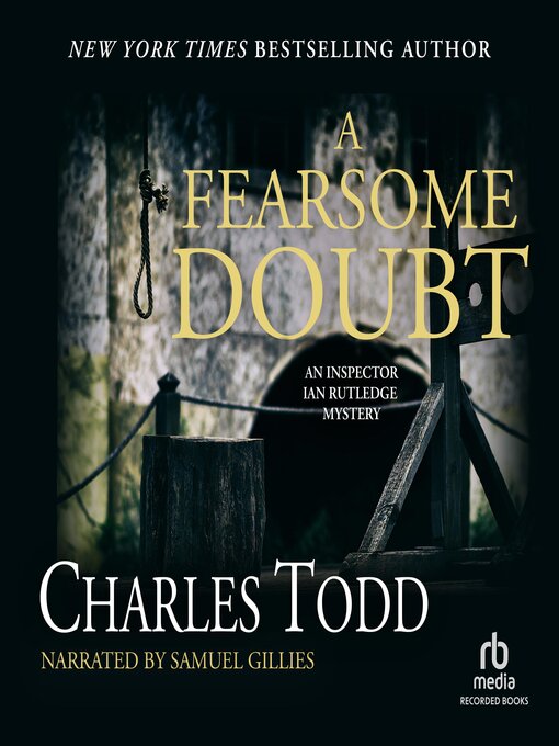
The audio books we've listened to on this trip were Reasonable Doubt, by Charles Todd -- a whodunit set in England in the 1920s; Murder in Mayfair, by D.M Quincy, a disposable mystery set in London in 1814, most remarkable for making almost no mention of any historical figures or events (I believe the name Napoleon came up once, but that's pretty much it; what's the point of "historical fiction" if you're not going to tie it into anything that makes a time unique or interesting?); Blue Moon, by Lee Child, an entertaining action story set in some unnamed American city, and featuring his crime-fighting hero Jack Reacher (I couldn't believe my luck when I found there was a Reacher novel I'd never read or listened to); The Evil Men Do, by John McMahon, another present-day crime thriller set in Georgia -- these novels make me wonder: when did fictional detectives quit being idiosyncratic, like Poirot and Marple and Queen and Stout, and instead all become flawed? Is anybody else tired of hearing about how the detective has to not only solve the crime but overcome alcoholism and the demons in their past all at the same time? That's not to say McMahon's book wasn't interesting -- it was -- but after a few of these novels they all start to feel formulaic. (On the other hand, there's Jack Heath's detective Timothy Blake, a cannibal who savors his flaws.) We also started Alan Furst's novel Under Occupation, a spy thriller set in occupied France, but didn't finish it. Usually we just abandon whatever we were listening to when we get home, but this one's not very long and I'm enjoying it, so I'm going to listen to the rest of it on my own.
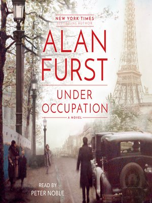
https://img1.od-cdn.com/ImageType-400/5054-1/5B0/A65/79/%7B5B0A6579-3E3C-4BD1-BE8A-29ABC9B8A07A%7DImg400.jpg

And here, once again, is a link to the picture album for this trip.

And again: if you're reading this in your email, please click on the link to the actual blog before you delete it, so it'll register as having been seen. My blog visitor numbers are pathetic, and you have it in your power to do something completely altruistic that will make a certain someone happy. You don't have to actually read it again when you visit the blog; though I think it's always worth reading again....

Friday, October 7, 2016

This Year's Huntsman Trip Pictures Posted

The pictures for this year's trip to the Huntsman Games are up now. They include photos taken at Bisti Wilderness in New Mexico, Grand Staircase-Escalante National Monument and Capital Reef National Park, Utah. My favourites are the pics from Calf Creek Falls, the high point of a six-hour hike. Carly liked that part best, too.
Bisti Wilderness

Capital Reef


Devil's Garden
Calf Creek Falls

Saturday, October 1, 2016

Good Food in Albuquerque

Mac's La Sierra
6217 Central Avenue NW, Albuquerque
(just east of Coors Boulevard)

For a South Texas boy like me, finding acceptable Mexican food west of the Pecos is a challenge; finding good Mexican food was, I thought, beyond hope. I feel renewed now, though.

The desk clerk at our hotel recommended this place; I almost didn't take up her suggestion, because it seemed a little too far, especially since my experiences of Mexican food out here have all been pretty dismal. But what the hell, I decided; the alternative she suggested was Chili's, which held no attraction for me either. At least, I figured, I might get a good, snarky review out of the local place.

First, the look of it: straight out of a Southwestern version of Happy Days, the show they should have made, but with Nacho instead of Fonzie. The place looks like it was built in the 50s, added onto in the 60s, and untouched since. Could use a larger parking lot, but otherwise it exudes a working-class cultura-coche charm: soda fountain-style stools in the front, tables and booths in the back (and I think there was another dining room beyond the kitchen). All done up in a red shade you haven't seen since before Nixon resigned, with some classically uninteresting prints on the walls.

Next, the service: after an initial bobble -- a pregnant pause before menus and water appeared -- the service was excellent, and included an apology for the misunderstanding between staff members that resulted in the delay. The waitress was very helpful as we tried to make our selections (one of the big problems with trans-Pecos Mexican food is the language barrier: they use the same words, but for all different things). And all her recommendations proved solid.

The food was almost great. The chips were only so-so, but the salsa was pretty good. My wife chose the daily special for her meal: green chili stew. I had just a taste of it, but found it delicious and piquant, and it sure looked good, with nice chunks of potato and other good things in a deep dish of ... well, green chili salsa. My own dish was the "house special," steak fingers and enchiladas, with an egg added (one of the waitress's recommendations). It was served with charro beans, some pretty good Spanish rice, a little salad, three very small breaded steak fingers (which looked kind of sad all by themselves on a side plate), and puffed bread called sopapillas. (Sopapillas are a dessert dish back home....) Because I'd ordered the egg on top, the enchiladas were served open, and topped on one side with red salsa (which they call "chili" here) and on the other with green salsa.

My biggest objection to the style of Mexican food out here is the amount of chili powder they use in their red salsas: it's overpowering. But tonight I discovered that if you mix a runny egg yolk into it, it becomes quite good. Better than merely acceptable. And except for the puniness of those steak fingers (which still tasted good; well, they're fried, you know, and fried food is always tasty. You could deep fry squirrel leg and it'd be good eatin', as I'm sure most of my peeps in West-by-God-Virginia can attest), everything was really enjoyable. The salad was fresh, the tortillas in the enchiladas had excellent texture, the cheese was creamy and not so profuse as to be overdone (a common affliction of many  American adaptations of ethnic cuisines), and even the bread was flavourful, if not as tasty as a good flour tortilla.

We had all this for about ten bucks a head. That, I think, is pretty good value.

THE CURMUDGEON'S RATINGS:
FOOD: 4 1/2 chili peppers (out of 5)
SERVICE: 4 1/2 chili peppers
AMBIENCE: 3 1/2 chili peppers
VALUE: 3 1/2 chili peppers
Mac's La Sierra Menu, Reviews, Photos, Location and Info - Zomato 

Friday, October 23, 2015

The 2015 Huntsman Trip

Fresh from my trip to Wisconsin in September, after a week of decompression (and laundry), the wife and I took off for Utah, where she was registered to play soccer in the annual Huntsman Games, a seniors' sports tournament with any number of different competitions. She has found herself a team out of Dallas (with a few stray members from Oregon --- don't ask me how that happened), and this is her second time in the competition. As we tend to do, we combined the trip with other, theoretically less strenuous, things.

We prepared for the trip by getting our new dog Carly medications to deal with motion sickness: she pukes when we drive. We had the same problem with our dog Homer, of beloved memory, but he grew out of it fairly quickly, and we hope Carly will, too. In fact, after two days of medication (during which she was somewhat listless, though not as drugged-out as Homer had been), we decided she didn't really need it all that much, at least on the highway; and indeed, after that she only threw up once, in city traffic. So I guess it's not the motion so much as the unanticipated stops, starts and turns that upset her.

Study in Black and White

We spent the first night in Alamogordo, at a barely-acceptable motel in the run-down part of town, then went out early to White Sands. I had been there a couple of years ago, both in the afternoon and the morning, and am still amazed at the differences in the light there. But this time, sadly, the sky was heavily overcast, so the pictures aren't as eyepopping as they were back then. But doesn't Carly look good in that landscape!

De-Na-Zin

From there, we drove up toward Farmington, in the northwest corner of the state, stopping at Bisti (or De-Na-Zin) Wilderness. (Not sure why the two names.) Not an easy place to find: county roads, some unpaved, and almost no signage. The wilderness area stretches some miles across an Indian reservation, and photos I've seen of it make it look like a spectacular landscape. We, however, were (it appears) at the other end of the wilderness area, which was nowhere near as eerie. Pretty, but not up to expectations. In any case, storms were coming in from the west, so we spent only a short time hiking in the stark desert valley.

the other end of the Wilderness
(photo from Roadtrippers.com)


and there's a rainbow, too!


Next morning we were off early again, and happened to be at Shiprock, New Mexico, just as the sun was hitting the eponymous rock. 


Sherry waving from the promontory
Natural Bridges NP
From there, we went up to Natural Bridges National Park, one of the older parks in Utah. There are three main natural bridge formations in the rock --- rock that is far, far older than at Arches, and not as colourful, but still impressive. We found a trail to one that didn't look too strenuous, but there were ladders along the way that we couldn't traverse with Carly. So we took turns: I waited with the dog while Sherry hiked out to the viewpoint, about twenty minutes' trek each way, then I went while she waited. (There was another trail that led down to the actual bridge, but that was much, much longer and about a 600' drop.) By the time we got to the last bridge site, those storms were about to hit again, so we went for the car and headed off to Torrey, Utah, the other side of Capitol Reef, for the night. I had planned originally to spend time at Cap Reef, but we decided that it was better to spend more time exploring Natural Bridges instead. We'll have to go back to Cap Reef (again) some day --- after all, that was what prompted me to buy an off-road-capable vehicle in the first place --- but other than a drive through it on the flooded highway, we didn't see any of it.

I had, of course, no intention of spending 3 days watching old women play soccer again --- after Escondido, I probably never will --- so I had arranged for my friend Curtis to come up from Las Vegas, and he and I went up to Bryce Canyon for a little hiking. We got to the park in the afternoon, checked into our hotel, and after a really, really bad lunch at a really crappy local fast-food joint -- the only place we could find -- we went into the park and hiked the Queen's Garden trail, so called because there's a rock that looks like a well-known statue of Queen Victoria. And it really does. 

Next morning we drove over to the optimistically named town of Tropic, Utah, and hiked into the canyon on the trail from there, a good morning's travel, during which I was confirmed in my opinion that Carly is not a good hiker's companion. Yet. Maybe when she's older.


That night, Curtis having returned to his digs in the Sin Capital of America and I to my hotel in Hurricane, Utah, we went to a team dinner at a really nice restaurant on a cliff overlooking the small city of St. George, where the Huntsman Games are held. Wish I could remember the name of it. On Saturday, Sherry's team won the Silver Medal in the women's over-60 soccer tournament, and we headed down the road to Havasu for a week's visit with her dad Ben and his wife Lana. 

When they bought the house out there, they brought the boat out from Phoenix, and bought a pair of waverunners and a rail (sort of a dune-buggy), so I was looking forward to some novel and exciting activities. But one of the waverunners had been sold, as junk apparently, and the rail had a flat tire and no clutch, which left one waverunner and the
London Bridge
boat. And of course the first few days were spent just visiting, though Sherry got her exercise by digging a trench in the back yard for electric lines going out to the gazebo her dad had put in. (I helped a little, just to have something to do besides walk and go take pictures of London Bridge.) Finally came the day when we took the surviving waverunner down to the lake and put it in. I took a couple of rides on it. It's fun, but would be more fun if somebody else could have come along. It's like a motorcycle, but with a soft landing when you fall off. (I didn't.) I'd do it again, but living where I live I don't see much point in owning one (or two). That part of Lake Havasu, slightly south of the bridge, isn't very crowded, at least on weekdays, but there were enough kids on loud machines churning doughnuts in the no-wake zone to keep me irritated.
Fritz and Carly

Carly had the best time of her short life in Havasu, since Ben & Lana have a puppy -- a giant puppy -- about her age, named Fritz. They kept each other entertained the entire time we were there.

We were going to take the boat out the next day, but the weather called for thunderstorms, so that was out; and the day after that, when we actually got some lightning (though not much else). And after that, we headed home.

To find a giant crack in our bedroom ceiling. It collapsed today. Ain't life grand.

Friday, September 21, 2012

Western Voyage of Discovery Under Way

White Sands National Monument
The first few days' worth of pictures from the Western Voyage of Discovery have been posted. Hard to believe we've done all this in only four days: Carlsbad Cavern, White Sands, El Camino Real International Heritage Center, the Very Large Array, La Ventana, El Malpais, El Morro and the Painted Desert. But we have, Rick and I, and we expect to have much, much more in the coming days.  Anyway, to take a look at the pics so far, click here.

Wednesday, September 1, 2010

On the Road Again

Back on the road for five days now, a different state every night. We left home Saturday, after depositing Homer at Doggy Camp (because he's just not fat enough) and headed west on ... ugh ... the freeway as far as Fort Stockton; then went north through Carlsbad and Roswell to Albuquerque, where we had a short visit with my old friend Kilby, who recently moved back there from Pennsylvania. Next morning, up the road to Colorado (completing, incidentally, New Mexico on my County Count, not that that matters). I decided I'd planned too much driving for Sunday, so instead of going up to Pagosa Springs, we went into Colorado at Durango, then up the San Juan Skyway through Silverton and Ouray (where we had lunch at Billy Goat Gruff's Biergarten, with good local beer and reasonably good German food), then around the mountain to the entrance to the canyon where Telluride lies. We stopped at a place called Keystone Overlook and decided not to go into Telluride, which is just another quaint mountain resort town. Instead, we headed south and spent a good chunk of the afternoon touring Mesa Verde.

The Cliff Palace at Mesa Verde N.P.
The entrance road to Mesa Verde National Park is one of the most dramatic drives I've ever made. You start on the plateau; ahead of you is a mesa jutting out from the higher plateau, maybe 900 or 1000 feet high. The road into the park loops into the canyon east of the promontory, then rises in a series of switchbacks until you're up on the higher plateau. From the top you can see a hundred miles, to the mountains we had been in earlier that day. 

The visitors' center is fifteen miles from the park entrance. (I had no idea just how big these western parks are.) There you can arrange a place on a guided tour of several of the primary cliff-dwellings; we opted for the 5pm tour of the Cliff Palace, the largest collection of ruins in the park (which, I believe, is the largest collection of such ruins in the world). Another five miles took us to the place, where we waited on an overlook for the rest of our tour and our guide.

We, it turned out, were the entire 5pm tour, so we ended up with a private tour by Ranger Jo, a woman in her 70s who humped up and down the steep trail like a mountain goat. She pointed out a stand of wireweed and had us taste it; this was, according to her, the only "salad" the indians had. In the spring, she says, it tastes like celery; this time of year it's similar but bitter.

Ranger Jo has been around Mesa Verde a long time, and knows the history of the park from a personal point of view. That made for an interesting and occasionally idiosyncratic tour, which we enjoyed thoroughly; though I could have done with fewer reports of conversations she's had with "Grandfather," a Pueblo Indian of her acquaintance who is her primary source on points of culture. I don't know the man, but from what she told us, he is pompous about Pueblo culture to the point of arrogance, or maybe just utterly ignorant of the culture of the white people around him. (Thinking about it reminds me of a line I heard from some woman doing stand-up on the Comedy Channel: "Somebody called me a racist. That's awful. That's an awful thing to say. That's worse than calling somebody a Mexican.") Anyway, we had a nice hour-long tour and then were on our own. We drove around the park, stopping here and there to get out and see various ruins in the canyons that cover the park.

Monday morning we stopped briefly at Four Corners, a dusty third-world outpost on the Navajo reservation where four states come together. We took the obligatory photographs of ourselves standing if four states at once, had a nice chat with a couple of the stray dogs, and left. 

The road west was under construction. There were crews doing resurfacing work along 100-yard-long stretches of highway, but they closed miles-long sections down to one lane to accommodate them, requiring additional personnel to drive the pilot cars. These drivers were also, apparently, in charge of passing on gossip to flagmen along the way, as we had several times to wait while our pilot exchanged pleasantries. Judging from the body language, he's an amusing conversationalist.


The road took us to Monument Valley, another Navajo tribal park. This one seemed much more developed on the way in, but the paved entrance and modern visitors' center and hotel proved to be just window dressing. The loop road that takes you down among the many fabulously-shaped buttes is not intended for passenger cars. (They don't tell you that at the gate, though the woman issuing our tickets was nice enough to suggest that we might want to put the top up.) The road is rocks and sand, more suited to a beat-up old Land Cruiser than a passenger car, and while I didn't bottom out, I had to attend so closely to choosing my path along this poorly-made roadway that I couldn't enjoy the scenery at all while we were moving. (I've seen better roads in the Congo.) After we'd gone about a third of the way down this 17-mile road, I decided that, since we'd already seen the major sites -- Elephant Butte, Camel Butte, the Mittens, the Three Sisters and one that looked for all the world like Droopy Dawg -- that I'd had enough, and we turned back. And got stuck in the sand.

In the Visitors' Center there's a panel talking about the creation of the park back in the 1950s, over the objection of some of the tribe. The argument that carried the day, it seems, was that if they put in a park it would keep white folk out of the rest of the Res. Every bump and rut in this pathetic road made it clear: they don't really want people to come visit. So, now that I've seen it, I'll never have to go back to the Navajo reservation. And now that I've seen Arches National Park, I won't much miss it. It ain't nothin' in comparison.

Landscape Arch
Arches National Park is one of those places that has to be seen to be believed. We got to the park around 5pm, and after a stop at Park Avenue, a line of impossibly thin vertical rock slabs like skyscrapers lining a city street, and Balanced Rock, we drove to Devil's Garden, at the farthest end of the park, and hiked out to Landscape Arch. This gossamer rock vault is three hundred feet long, and looks like a stiff breeze would topple it. I had seen it pictured on a magnet in the Visitors' Center, and thought afternoon would be the best time to get pictures of it. We were going to go back to the park early the next morning to get photos of other sites.

Unfortunately, Landscape Arch is situated so that by evening it's pretty much in the shade, as you can see. Morning would have been better. Oh, well. But the next morning we went to the Delicate Arch Viewpoint, a climb of about 200 feet from the parking area. To get to the arch itself would have been twice as high a climb and three times as long a hike, so we decided not to do it. Instead we went to the areas called The Garden of Eden and The Windows, both of which were stunning no matter which way you look.

Leaving Arches yesterday morning, we drove across Utah, along one of the better freeway drives in the country -- Interstate 70 across the unusual landscape of the San Rafael Uplift -- and then onto US 50, into the Great Basin. Four years ago I had gone to the Great Basin National Park Visitors' Center to get a passport stamp, but arrived fifteen minutes after closing. My intention in planning the day's drive had simply been to try again for a stamp -- there didn't seem to be any big attraction at the park, which seems to exist only for people who like to hike and fish and stuff. But on arriving in time to get the all-important passport stamp, I found that there's a drive that goes up to view the glacier on the side of Mount Wheeler, and the ranger said it only took about 45 minutes to get up there. It was early enough in the day, so we made the drive.

I'd never seen a glacier before. Now that I've seen one, I'd kind of like to see a real one. Technically I suppose it is a glacier, this paltry patch of white stuff on the north face of the mountain, but it's hardly the kind of thing we southern boys envision when we hear the word "glacier," which usually occurs in the context of grinding out landscape for huge lakes and mountains. This thing hardly seemed adequate for two pitchers of margaritas. Guess I'll have to go to Alaska sooner than planned.

Last night we stayed in Ely, Nevada, an unimpressive little town an hour from the Great Basin park; today we drove across Nevada on US 50 (which Life Magazine once dubbed "America's Loneliest Road," recommending against driving it "unless you're confident of your skills." I guess it's been improved significantly since then, as it's a pretty good road, even through the many mountain ranges it crosses) and are now holed up for two nights in South Lake Tahoe, California. I'm really, really, really looking forward to a day of rest.